Providence Maps and Orientation
(Providence, Rhode Island - RI, USA)
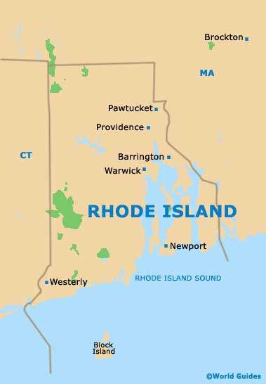
Sited within the northeastern quarter of the Ocean State of Rhode Island, Providence is a medium-sized city with a population of just under 200,000 people.
Providence lies roughly in between the town of Barrington and the small city of Pawtucket, being close to Greenwich Bay and in the region of 30 miles / 48 km from the North Atlantic Ocean coastline, which resides to the south.
The southerly coastline is best reached via Interstate I-95 (Route RI-4 / Colonel Rodman Highway), which passes by East Greenwich and heads all the way to Narragansett. Of note, the seaside town of Narragansett is known for its sandy beaches and Fishermen's Memorial State Park.
Maps and Orientation of the City
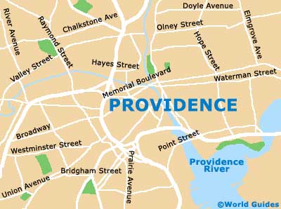
Maps of downtown Providence will show how Interstate I-95 connects the city center, which can be reached by taking junction 22.
Take a stroll to the east and you will find the campus of the Brown University, while to the west is the Italian-themed Federal Hill district, centered around Federal Hill and Atwells Avenue. Numerous trattorias provide endless pasta and pizza dishes in this part of Providence.
- Attleboro - 13 miles / 21 km (20 minutes, northeast)
- Barrington - 11 miles / 18 km (18 minutes, southeast)
- Central Falls - 7 miles / 11 km (15 minutes, north)
- Cranston - 6 miles / 10 km (12 minutes, south)
- Cumberland - 15 miles / 24 km (25 minutes, north)
- East Greenwich - 16 miles / 26 km (25 minutes, south)
- Elmwood - 3 miles / 5 km (ten minutes, south)
- Johnston - 5 miles / 8 km (12 minutes, west)
- Mount Pleasant - 3 miles / 5 km (ten minutes, west)
- North Attleborough - 13 miles / 21 km (20 minutes, north)
- Pawtucket - 6 miles / 10 km (12 minutes, north)
- Rumford - 7 miles / 11 km (15 minutes, east)
- Seekonk - 6 miles / 10 km (12 minutes, east)
- Wanskuck - 3 miles / 5 km (ten minutes, north)
- Warwick - 12 miles / 19 km (20 minutes, south)
- Woonsocket - 16 miles / 26 km (25 minutes, north)
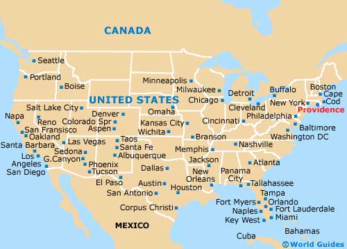
Map of the United States
Map of Rhode Island
Map of Providence