Harrisburg Maps and Orientation
(Harrisburg, Pennsylvania - PA, USA)
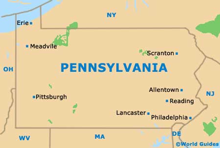
The state of Pennsylvania is sited on the far northeastern side of North America and is where you will find Harrisburg, its capital city. Also the county seat for Dauphin County, the state capital of Harrisburg sits in the state's southeastern quadrant.
With its population of approximately 50,000 people, Harrisburg is far from being the biggest city in Pennsylvania, despite being the state capital. In fact, it is only the state's ninth-largest city, after
Philadelphia (1.6 million), followed by
Pittsburgh, Allentown, Erie, Reading, Scranton, Bethlehem and
Lancaster.
The city has grown up on the eastern bank of the meandering Susquehanna River and is conveniently sited close to a number of prominent highways, such as interstates I-76, I-81, I-83 and I-283. On the southern side of the city are both the Capital City Airport and the Harrisburg International Airport, while to the north are various green spaces, such as the Blue Mountain Park, Hocker Park and the Boyd Big Tree Conservation Area State Park.
Maps and Orientation of the City
Downtown Harrisburg is not overly large, meaning that getting around is usually very straightforward, especially if you are using a map. Bearing in mind notable local landmarks will help you gain your bearings, such as the Pennsylvania State Capitol and St. Patrick's Cathedral.
As Harrisburg has expanded its boundaries over the decades, a series of adjoining neighborhoods have come into being. These include the likes of Allison Hill, Bellevue Park, Capitol Heights, Engleton, Midtown, Steelton and Uptown, as well as the Central Business District and SoMa (the South of Market District).
- Allentown - east
- Carlisle - west
- Colonial Park - east
- Columbia - southeast
- Elizabethtown - southeast
- Gettysburg - southwest
- Hanover - south
- Hershey - east
- Lancaster - southeast
- Lebanon - east
- Millersburg - north
- Milton - north
- Progress - east
- Westminster, Maryland (MD) - south
- York - south
Map of USA
Map of Pennsylvania
Map of Harrisburg
