Columbus Maps and Orientation
(Columbus, Ohio - OH, USA)
Enjoying a central situation within the state of Ohio, where it serves as the state capital and also the biggest city, Columbus is situated alongside Appalachia and the Rust Belt. The city is also the administrative center of Franklin County and has expanded considerably over the years, to also encompass areas of both Delaware and Franklin counties.
The Columbus Metropolitan Area comprises a series of rivers and tributaries, which have shaped much of the landscape and greatly affected the overall layout of the city itself. Lying on the western side of the downtown district of Columbus is the meeting point of the Olentangy River and the Scioto River, while the creeks of Alum, Big Walnut and Darby meander their way through the metropolitan area.
Finding your way around downtown Columbus is made all the easier by using a map and looking out for prominent city landmarks. The campus of the Columbus State Community College lies on the northeastern side of downtown and is where you will find Eibling Hall and Nestor Hall. East Broad Street bounds the southern side of the college, being home to the city's Museum of Art. Further south is the Metropolitan Library and the Grant Medical Center.
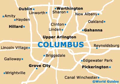
Maps and Orientation of the City
To the west of downtown Columbus is the Arena District and Huntington Park, with the Uptown District and the City Hall being found roughly west-southwest, and the River South District to the southwest.
Head to the far southwest and you will soon encounter the Brewery District and the Lou Berliner Park.
- Alum Creek State Park - 22 miles / 35 km (35 minutes, north)
- Battelle Darby Creek Metro Park - 15 miles / 24 km (25 minutes, southwest)
- Circleville - 25 miles / 40 km (40 minutes, south)
- Gahanna - 8 miles / 13 km (15 minutes, northeast)
- Grove City - 9 miles / 14 km (15 minutes, southwest)
- Hoover Reservoir Park - 19 miles / 31 km (30 minutes, northeast)
- Huber Ridge - 12 miles / 19 km (20 minutes, northeast)
- Lincoln Village - 9 miles / 14 km (15 minutes, west)
- Pickerington - 17 miles / 27 km (30 minutes, southeast)
- Powell - 16 miles / 26 km (25 minutes, north)
- Prairie Oaks Metropark - 18 miles / 29 km (30 minutes, west)
- Reynoldsburg - 12 miles / 19 km (20 minutes, east)
- Upper Arlington - 5 miles / 8 km (12 minutes, northwest)
- West Jefferson - 16 miles / 26 km (25 minutes, west)
- Westerville - 15 miles / 24 km (25 minutes, north)
- Worthington - 11 miles / 18 km (20 minutes, north)
Map of the United States

Map of Ohio

Map of Columbus