Durham Maps and Orientation
(Durham, North Carolina - NC, USA)
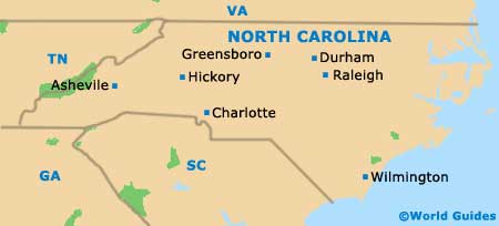
Located on the northeastern quadrant of North Carolina and directly east of Greensboro (roughly 33 miles / 53 km away), the city of Durham serves as the seat for Durham County. However, its spreading boundaries also include areas of both Orange County and Wake County.
Together with nearby Chapel Hill and Raleigh, Durham makes up North Carolina's important Research Triangle area, where three prestigious research universities are based. Of note, Durham resides on the northeastern side of the Triangle.
This medium-sized city is greatly influenced by its high concentration of students. The downtown district can be a quiet spot by day, and then full of activity the next, particularly when a baseball game is underway at the Durham Bulls Athletic Park (DBAP) on Blackwell Street.
Maps and Orientation of the City
Many tourists exploring Durham city center are naturally drawn to Brightleaf Square. This plaza is situated on the eastern side of the downtown district, where it is known for its wealth of shopping and dining opportunities, often housed within converted warehouses. Maps are available at the Durham Visitor Center, which is to be found on East Morgan Street, within the Warehouse District and close to North Mangum Street, the City Hall Plaza and the First Baptist Church.
Lying on the northeastern side of Durham is the Duke University campus and the lively Ninth Street area, where so many students are based.
- Bennett Place - 7 miles / 11 km (12 minutes, west)
- Burlington - 33 miles / 53 km (50 minutes, west)
- Cary - 21 miles / 34 km (30 minutes, southeast)
- Chapel Hill - 11 miles / 18 km (20 minutes, southwest)
- Eno River State Park - 11 miles / 18 km (20 minutes, northwest)
- Green Level - 31 miles / 50 km (45 minutes, west)
- Hillsborough - 15 miles / 24 km (25 minutes, northwest)
- Jordan Lake State Recreation Area - 29 miles / 47 km (45 minutes, southwest)
- Leesville Forest - 11 miles / 18 km (20 minutes, southeast)
- Mebane - 23 miles / 37 km (35 minutes, west)
- Morrisville - 15 miles / 24 km (25 minutes, southeast)
- Raleigh - 28 miles / 45 km (40 minutes, southeast)
- Research Triangle Park - 8 miles / 13 km (15 minutes, southeast)
- Treyburn - 13 miles / 21 km (25 minutes, northeast)
- Woodcroft - 7 miles / 11 km (12 minutes, south)
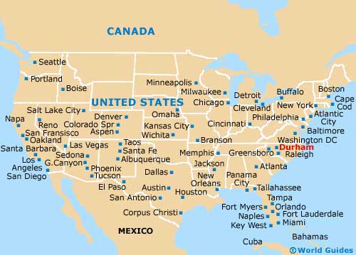
Map of the United States
Map of North Carolina
Map of Durham

