Buffalo Maps and Orientation
(Buffalo, New York - NY, USA)
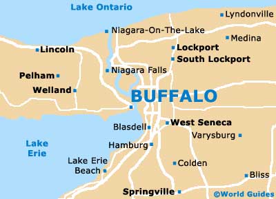
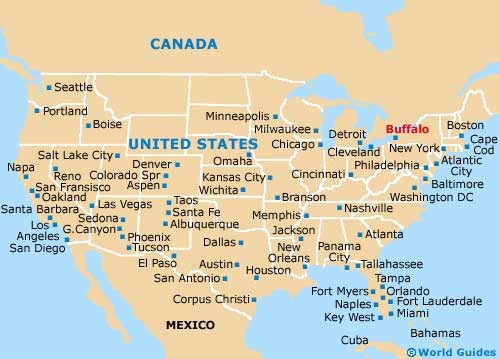
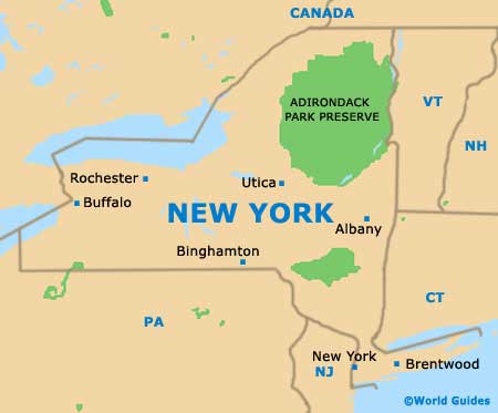
Located on the far westerly side of New York State and close to the Canadian border, Buffalo lies alongside Lake Erie and the Niagara River. The city serves as the seat for Erie County and is a part of the sprawling Buffalo-Niagara Falls metropolitan area.
Various freeways and major roads intersect and bound the city. The Buffalo Skyway (NY-5) is one such road and heads in a northwest to southeast direction, next to Lake Erie and passing by the Tifft Nature Preserve. The Niagara Thruway (Interstate I-90) connects Kaisertown in the east with Grand Island and the Niagara Falls area to the far northwest.
The eastern side of the city is edged by the New York State Thruway (Interstate I-90), which links West Seneca in the south with Cheektowaga, the
Buffalo Niagara International Airport and the Westwood Country Club, before becoming the Youngmann Memorial Highway (Interstate I-290) and joining the Lockport Expressway (Interstate I-990).
Maps and Orientation of the City
Those who appreciate fine architecture should grab a map and take a stroll around the city of Buffalo. Look out for the imposing Prudential Building on Church Street, the eye-catching Art Deco facade of the City Hall on Niagara Square, and also the Old Post Office and its Neo Gothic character, as well as the famous houses of Frank Lloyd Wright.
- Albany - 288 miles / 463 km (seven hours, east)
- Bliss - 52 miles / 84 km (one hour and 15 minutes, southeast)
- Colden - 27 miles / 43 km (40 minutes, south)
- Dansville - 85 miles / 137 km (two hours, southeast)
- Lockport - 29 miles / 47 km (45 minutes, northeast)
- Medina - 43 miles / 69 km (one hour and ten minutes, northeast)
- Niagara Falls - 22 miles / 35 km (35 minutes, northwest)
- Niagara on the Lake - 36 miles / 58 km (50 minutes, north)
- Rochester - 74 miles / 119 km (one hour and 40 minutes, northeast)
- Springville - 35 miles / 56 km (50 minutes, south)
- St. Catharines - 56 miles / 90 km (one hour and 20 minutes, northwest)
- Tonawanda - 8 miles / 13 km (15 minutes, north)
- Utica - 198 miles / 319 km (four hours and 30 minutes, east)
- Welland - 38 miles / 61 km (55 minutes, west)
- West Seneca - 7 miles / 11 km (15 minutes, south)
Map of the United States
Map of New York State
Map of Buffalo