Taos Maps and Orientation
(Taos, New Mexico - NM, USA)
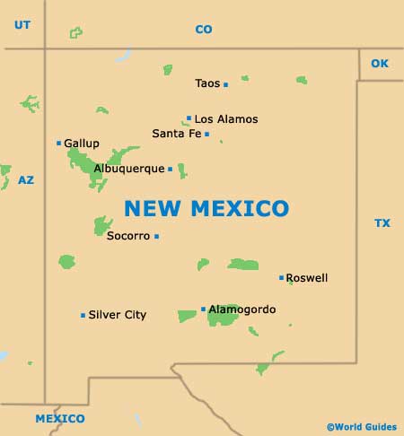
Situated on the northern side of New Mexico and within reach of the Colorado border, the town of Taos belongs to the county of the same name, where it is both the county seat and the biggest town.
Also located within this county are the towns and communities of Arroyo Hondo, Arroyo Seco, El Prado, Las Trampas, Ojo Caliente, Pilar, Ranchos de Taos and Red River, as well as the Taos Ski Valley resort.
The town itself is relatively flat, although its northern boundary is rather dominated by the dramatic natural backdrop provided by the Taos Mountain. Dissecting the town into easterly and westerly zones, the Paseo Del Pueblo Sur (Highway US-68) heads northwards to El Prado and beyond, and southwards to the neighboring towns of Ranchos de Taos and Llano Quemado. Heading eastwards is the Paseo del Canon East (Highway US-585), which connects the Kit Carson Road (Highway US-64).
Maps and Orientation of the Town
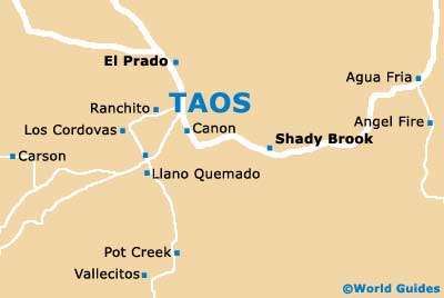
Downtown Taos is relatively compact and finding your way around is often as simple as looking out for prominent local landmarks, attractions and hotels. These include the Harwood Museum of Art, the Hotel La Fonda, the Inn on La Loma Plaza and the Kit Carson State Park. Just over a five-minute drive to the northeast, the Taos Pueblo settlement and its characterful 15th-century dwellings serves as the town's principal tourist magnet.
Located on the southern side of Taos, the town's very own Visitors Center is a good place to source maps and is to be found on the Paseo del Pueblo Sur, being close to the Days Inn hotel, the Vietnam Veterans Memorial and the St. James Episcopal Church.
- Agua Fria - 74 miles / 119 km (two hours, southwest)
- Albuquerque - 131 miles / 211 km (three hours and 15 minutes, southwest)
- Angel Fire - 22 miles / 35 km (40 minutes, east)
- Carson - 19 miles / 31 km (30 minutes, west)
- Carson National Forest - 50 miles / 80 km (one hour and 25 minutes, west)
- Chamisal - 29 miles / 47 km (50 minutes, southwest)
- Chimayo - 51 miles / 82 km (one hour and 25 minutes, southwest)
- Cimarron - 55 miles / 89 km (one hour and 30 minutes, east)
- El Prado - 2.5 miles / 4 km (five minutes, north)
- Los Alamos - 67 miles / 108 km (one hour and 40 minutes, southwest)
- Los Cordovas - 5 miles / 8 km (12 minutes, west)
- Questa - 24 miles / 39 km (40 minutes, north)
- Ranchos de Taos - 4 miles / 6 km (ten minutes, south)
- Santa Fe - 70 miles / 113 km (one hour and 45 minutes, southwest)
- Shady Brook Village - 13 miles / 21 km (25 minutes, east)
- Taos Ski Valley - 20 miles / 32 km (30 minutes, north)
- Vallecitos - 52 miles / 84 km (one hour and 25 minutes, west)
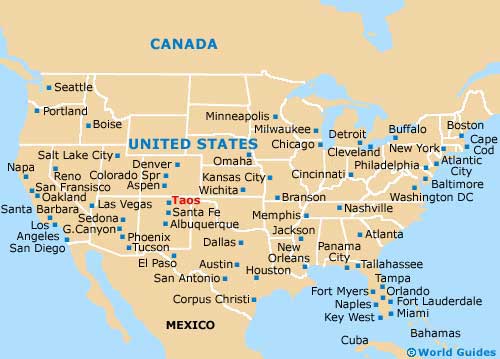
Map of the United States
Map of New Mexico
Map of Taos