Kissimmee Maps and Orientation
(Kissimmee, Florida - FL, USA)
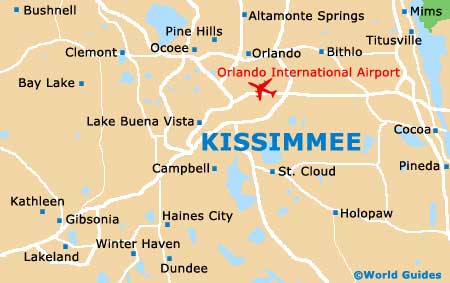
Located in the center of the Florida peninsula and a part of the Orlando-Kissimmee-Sanford, Florida, Metropolitan Statistical Area, the small city of Kissimmee resides within Osceola County, where it is the county seat.
The city sits especially close to both St. Cloud and
Orlando, as well as Lake Tohopekaliga (Lake Toho) and East Lake Tohopekaliga. Those driving between Kissimmee and Orlando will find that the Ronald Reagan Turnpike (Florida's Turnpike SR-91) provides a simple and speedy route, connecting to the Interstate I-4 at Oak Ridge (close to the Universal Orlando Resort theme park). This journey should take roughly 35 to 45 minutes.
Holiday makers choosing to take advantage of the more affordable accommodation offered by hotels in Kissimmee will find that the principal attractions of Orlando are within comfortable driving distance. The Walt Disney World Resort resides just over 12 miles / 19 km to the northwest, being reached via the North John Young Parkway, West Vine Street / West Irlo Bronson Memorial Highway (US-192). This route leads to the World Center Drive (SR-536) and joins the Epcot Center Drive at Disney's Typhoon Lagoon Water Park, crossing the I-4.
Maps and Orientation of the City
Since many people visiting this part of Florida use Kissimmee as a base for exploration of the area, renting a car is generally the favored mode of transport. Maps and sat-nav will help you find your way around Osceola County, Orange County and beyond.
Downtown Kissimmee is very walkable and is based around the junction of highways US-192 and US-17/92. This district is devoid of high-rise buildings, with the tallest being the Osceola County courthouse, a useful point of reference. Prominent local thoroughfares include Broadway Street, Drury Avenue, Emmett Street, John Young Parkway and Main Street.
- Altamonte Springs - 33 miles / 53 km (50 minutes, north)
- Bradenton - 107 miles / 172 km (two hours and 30 minutes, southwest)
- Daytona Beach - 78 miles / 126 km (one hour and 50 minutes, northeast)
- Deltona - 52 miles / 84 km (one hour and 20 minutes, northeast)
- Gainesville - 125 miles / 201 km (two hours and 45 minutes, northwest)
- Jacksonville - 163 miles / 262 km (three hours and 20 minutes, north)
- Lakeland - 46 miles / 74 km ( one hour and ten minutes, southwest)
- Merritt Island - 62 miles / 100 km (one hour and 30 minutes, east)
- Ocala National Forest - 90 miles / 145 km (two hours and 15 minutes, north)
- Orlando - 23 miles / 37 km (40 minutes, north)
- Ormond Beach - 84 miles / 135 km (two hours, northeast)
- Palm Coast - 104 miles / 167 km (two hours and 30 minutes, northeast)
- Sanford - 43 miles / 69 km (one hour and five minutes, northeast)
- St. Cloud - 9 miles / 14 km (15 minutes, southeast)
- St. Petersburg - 98 miles / 158 km (two hours and 20 minutes, southwest)
- Tampa - 75 miles / 121 km (one hour and 45 minutes, west)
- Titusville - 57 miles / 92 km (one hour and 25 minutes, east)
- Winter Haven - 34 miles / 55 km (50 minutes, southwest)
Map of the United States

Map of Florida

Map of Kissimmee