Boulder Maps and Orientation
(Boulder, Colorado - CO, USA)
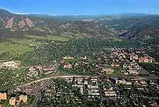
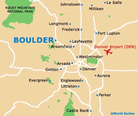
Situated at the very base of the famous Rocky Mountains, the city of Boulder lies in the state of Colorado, and within Boulder Count, when it has become the actual county seat. The city also stands close to the Great Plain and an area referred to as the Flatirons, which comprises vast areas of stone and rock formations, and can be found on the western outskirts.
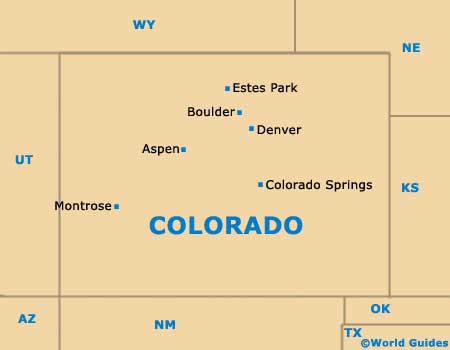
Boulder is a good place to base yourself if you are planning to explore Colorado, since it is relatively close to
Denver and also to
Colorado Springs , both of which lies to the south and are connected by the US-36 highway.
Maps and Orientation of the City
Boulder Creek is a significant flow of water close to the very heart of the city and this namesake river adds much character to the city's downtown area. Before reaching the city itself, the creek first flows into the Barker Reservoir and then through the Boulder Canyon.
Maps of the city and region are available for bookstore within the popular Pearl Street Mall, which has become an integral part of downtown Boulder and known for its vast pedestrian zone. Also of significance is the University Hill district, which is situated next to the university campus itself.
- Arvada - 24 miles / 39 km (35 minutes, southeast)
- Aspen - 219 miles / 352 km (five hours, southwest)
- Aurora - 37 miles / 60 km (50 minutes, southeast)
- Boulder Mountain Park - 2 miles / 3 km (five minutes, southwest)
- Broomfield - 15 miles / 24 km (22 minutes, southeast)
- Castle Rock - 57 miles / 92 km (one hour and 15 minutes, southeast)
- Centennial - 40 miles / 64 km (50 minutes, southeast)
- Colorado Springs - 97 miles / 156 km (two hours and 15 minutes, south)
- Denver - 30 miles / 48 km (45 minutes, southeast)
- Eldorado Springs - 8 miles / 13 km (18 minutes, south)
- Estes Park - 36 miles / 58 km (one hour, northwest)
- Ft. Collins - 55 miles / 89 km (one hour and 10 minutes, north)
- Greenwood Village - 41 miles / 66 km (50 minutes, southeast)
- Highlands Ranch - 52 miles / 84 km (one hour and 15 minutes, southeast)
- Lafayette - 12 miles / 19 km (25 minutes, east)
- Littleton - 40 miles / 64 km (50 minutes, southeast)
- Longmont - 16 miles / 26 km (25 minutes, northeast)
- Louisville - 11 miles / 18 km (20 minutes, east)
- Rocky Mountain National Park - 40 miles / 64 km (one hour, northwest)
- Westminster - 18 miles / 29 km (25 minutes, southeast)
Map of the United States

Map of Colorado
Map of Boulder