Flagstaff Maps and Orientation
(Flagstaff, Arizona - AZ, USA)
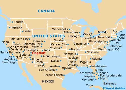
Sited on the northern side of central Arizona, Flagstaff stands directly to the north of
Sedona and within the county of Coconino, where it is both the largest city and also the county seat.
Flagstaff makes a good base for those on vacation, since it is relatively close to many interesting towns, cities and attractions. In fact, it is possible to reach the Grand Canyon in two hours or less, with this enormous valley being connected by the US-89 highway, which heads northwards. Both the cities of
Phoenix and
Scottsdale are also within driving distance of Flagstaff, being under four hours away.
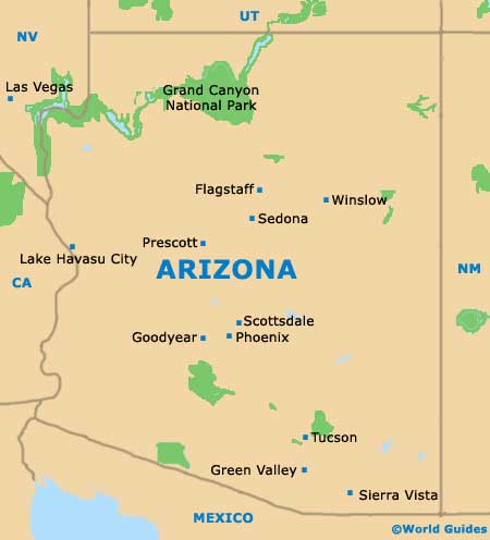
Interstate I-40 (Route 66) runs in an east to west direction. Head east along the I-40 and you will reach Winslow, Holbrook and the Petrified Forest National Park, while to the west is Parks, Williams and Ash Fork. The I-17 heads southwards to Sedona, the Village of Oak Creek, Camp Verde and Black Canyon City.
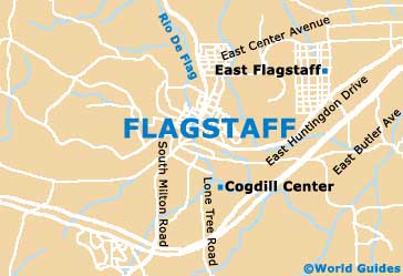
Maps and Orientation of the City
Maps of Flagstaff and Arizona are advisable for those with a rental car and planning to explore the region.
The Flagstaff Visitors Center is a good place to pick up maps, being located on East Santa Fe Avenue (East Route 66) and close to Heritage Square, the City Court and the Weatherford Hotel, and just across from the themed Collins Irish Pub and Eatery.
- Cameron - 54 miles / 87 km (one hour and 15 minutes, north)
- Camp Verde - 59 miles / 95 km (one hour and 25 minutes, southwest)
- Chandler - 169 miles / 272 km (four hours, south)
- Cottonwood - 51 miles / 82 km (one hour and ten minutes, southwest)
- Grand Canyon Village - 79 miles / 127 km (two hours, north)
- Kachina Village - 10 miles / 16 km (15 minutes, south)
- Lake Montezuma - 53 miles / 85 km (one hour and 15 minutes, south)
- Leupp - 44 miles / 71 km (one hour, northeast)
- Mesa - 163 miles / 262 km (three hours and 45 minutes, south)
- Munds Park - 22 miles / 35 km (30 minutes, south)
- Phoenix - 146 miles / 235 km (three hours and 30 minutes, south)
- Prescott - 97 miles / 156 km (two hours and 30 minutes, southwest)
- Scottsdale - 155 miles / 249 km (three hours and 45 minutes, south)
- Sedona- 31 miles / 50 km (45 minutes, south)
- Tempe - 154 miles / 248 km (three hours and 40 minutes, south)
- Tuba City - 78 miles / 126 km (two hours, north)
- Tusayan - 72 miles / 116 km (one hour and 50 minutes, northwest)
- Village of Oak Creek - 38 miles / 61 km (55 minutes, south)
- Winslow - 58 miles / 93 km (one hour and 25 minutes, east)
Map of the United States
Map of Arizona
Map of Flagstaff