Cancun Maps and Orientation
(Cancun, Quintana Roo, Mexico)
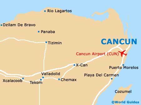
A popular and extremely appealing coastal resort on the far eastern side of Mexico, Cancun lies in the state of Quintana Roo. Often abbreviated as simply 'QR', Quintana Roo is the most easterly state in the whole of Mexico. Cancun borders the Caribbean Sea and is adjacent to the Isla Mujeres, with parts of the city comprising small island areas, linked by bridges.
The historic part of Cancun features a series of large districts, which are known locally as 'supermanzanas', being edged by major boulevards and thoroughfares. These supermanzanas feature many small urban areas and winding roads, often being home to a number of parks.
Maps and Orientation of the City
Much of the coastline around Cancun is dominated by hotel resorts, which line the white sandy beachfronts and overlook the sea. The Hotel Zone, referred to as the 'Zona Hotelera' (Isla Cancun) is where the majority of the hotels and apartment blocks are based in Cancun.
Locals residents are based in the neighbouring downtown area of Ciudad Cancun (El Centro), which is rarely visited by most tourists. Downtown Cancun is edged by the Avenida Tulum, with is a prominent road, heading in a north-south direction.
Maps of the Cancun area can be purchased at various locations around the city, including bookstores along the Avenida Tulum and the Boulevard Kukulcán. Here you will also find further regional maps and information about Quintana Roo as a whole, together with books on the Yucatán Peninsula.
- Alfredo V Bonfil - south
- Caracol - south
- El Rey - south
- Isla Blanca - north
- Isla Mujeres - north-east
- Kantunilkin - west
- Leona Vicario - south-west
- Moctezuma - north-west
- Nuctunich - north-west
- Odzceh - west
- Puerto Morelos - south
- Salsipuedes - north-west
- Valladolid - west
Map of Mexico

Map of Cancun