Halifax Maps and Orientation
(Halifax, Nova Scotia - NS, Canada)
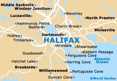
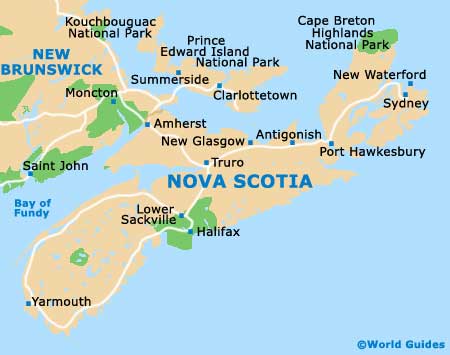
Located in the Canadian province known as Nova Scotia (NS), the city lies within the Atlantic provinces of Canada, where it has become part of the spreading Halifax Regional Municipality. The city comprises two mains areas, which are named as Mainland Halifax and also the Halifax Peninsula, while the Regional Municipality now encompasses many surrounding communities, such as Armdale, Fairview and Spryfield.
With a busy seaport and harbor, Halifax stands directly to the west of Dartmouth and this city is just a short drive away. The city center itself is split into a total of three neighborhoods - South End, North End and West End, being overlooked by the very easy-to-spot Citadel building.
Maps and Orientation of the City
Much of Halifax is very walkable and visitors wishing to find their way around are advised to pick up city maps from the Waterfront Visitors Information Center (VIC) on Sackville Street, at the Sackville Landing. Alternatively, those flying into the city may like to obtain their maps and leaflets from the Halifax Airport Visitor Information Center.
Map of Canada

Map of Nova Scotia
Map of Halifax