Salvador Maps and Orientation
(Salvador, Bahia, Brazil)
Located in north-eastern
Brazil and enjoying a peninsula setting, Salvador is often referred to as Salvador da Bahia and serves as the capital of the Bahia state. The city stands alongside the Atlantic coast, at the mouth of the Bay of All Saints (Baia de Todos os Santos), and has a population of just over three million residents, while the metropolitan area is called home by approximately four million.
Founded in the middle of the 16th century, Salvador is known for its characterful Old Town area, which now ranks as a World Heritage Site and plays an important part of the city's annual carnival celebrations.
Maps and Orientation of the City
The majority of visitors to Salvador are made up of tourists heading to the numerous beach resorts and neighbourhoods based where the bay joins with the ocean. However, the city itself actually sprawls inland for many kilometres and contains a number of important districts.
The city centre resides on the bay side, within the West Zone, and is split into two main regions - the Upper City (Cidade Alta) and the Lower City (Cidade Baixa). Pelourinho forms the very heart of Cidade Alta and is central to the tourism scene in Salvador, being a good place to pick up maps and brochures about the city. For detailed maps, look out for the map entitled the 'Geocad Mapa de Salvador'.
The beaches and attractions of Barra stand in the South Zone, together with the Campo Grande, Rio Vermelho and Vitória neighbourhoods. In the East Zone are the affluent districts of Brotas, Caminho das Arvores, Costa Azul, Itaigara, Itapoa, Jaguaribe, Pituba and Stella Maris.
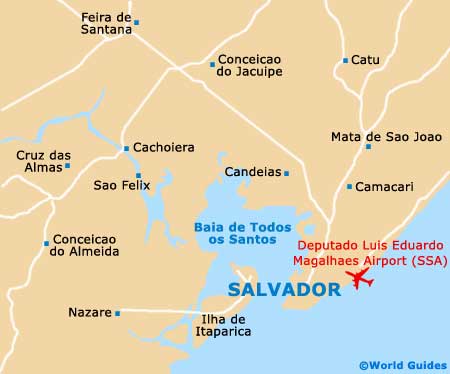
- Alagoinhas - north
- Camacari - north-east
- Candeias - north
- Catu - north
- Conceicao do Jacuipe - north
- Dias d'Avila - north
- Feira de Santana - north-west
- Itaparica Island (Ilha de Itaparica) - west
- Lauro de Freitas - east
- Madre de Deus - north-west
- Maragogipe - north-west
- Mata de Sao Joao - north
- Nazaré - west
- Pojuca - north
- Santo Amaro - north-west
- Sao Francisco do Conde - north-west
- Sao Sebastiao do Passé - north
- Saubara - north-west
- Simoes Filho - north
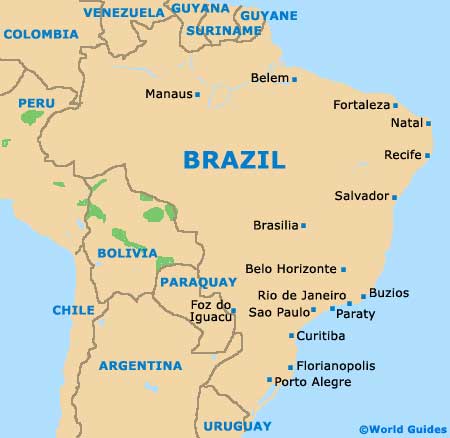
Map of Brazil
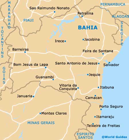
Map of Bahia
Map of Salvador