Manaus Maps and Orientation
(Manaus, Amazonas, Brazil)
A sizable, wealthy city located in Northern
Brazil and within the Amazon Rainforest, Manaus stands in the state of Amazonas, where it is the capital and biggest city. Manaus was established in the late 1660s and is now called home by more than two million residents. The Port of Manaus is an important part of the local economy and lies alongside the Negro River, close to the Amazon River and just under 1,500 km / 930 miles from the Atlantic coast.
Currently ranking as the second-biggest metropolitan area in the whole of Northern Brazil, Manaus has grown to become the 12th-largest city in this region. Although the city is sited within the Amazon, it actually has a fairly limited selection of parks, with the main green spaces being the Park of Bilhares, the Park of Mindu, the Park Sumauma and the Hill Aleixo area.
Maps and Orientation of the City
The architecture of Manaus is a tribute to its affluence and success, with many of the oldest and most famous buildings dating back to its days of rubber barons. As you find your way around the city, a number of the most prominent buildings serve as useful landmarks and points of reference.
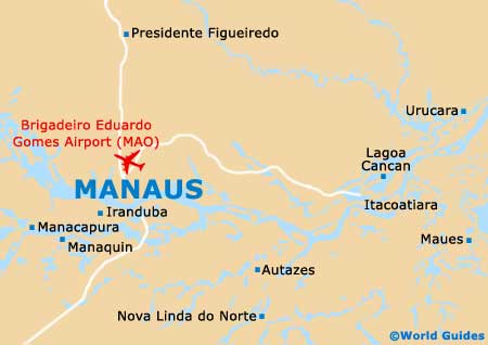
Those who require maps should be sure to check out the state tourism agency outlets. These are located at the corner of the Rua Tapajos and the Rua Ramos Ferreira, and the corner of the Rua José Clemente and the Avenida Eduardo Ribeiro. Maps of Manaus can also be obtained from the tourist kiosk at the Brigadeiro Eduardo Gomes International Airport.
- Autazes - south-east
- Careiro da Varzea - south-east
- Igarapé do Taruma-acu - north-west
- Iranduba - south-west
- Itacoatiara - east
- Lago Cabaliana - west
- Lago Janauac - south-west
- Manacapuru - west
- Manaquiri - south-west
- Novo Airao- north-west
- Nova Olinda do Norte - south-east
- Pa do Mamori - south
- Parana do Careiro - south-east
- Presidente Figueiredo - north
- Rio Preto da Eva - north-east
Suburbs and Neighbourhoods
- Col. Terra Nova - north
- Educandos - south
- Mauazinho - east
- Monte das Oliveiras - north
- Morro da Liberdade - south
- Novo Israel - north
- Parque Dez de Novembro - north
- Puraquequara - east
- Santa Etelvina - north
- Sao Raimundo - south
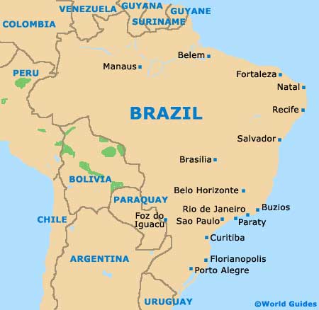
Map of Brazil
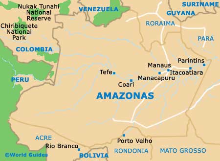
Map of Amazonas
Map of Manaus