Sardinia Maps and Orientation
(Sardinia, Italy)
Sardinia sits in the middle of the Mediterranean, just below the French island of Corsica, and about a third of the way between the Italian Peninsula and the Spanish east coast.
Sicily is off to the south-east and the coast of North Africa / Tunisia is the same distance, again due south.
Sardinia is an autonomous region of Italy and is a large island - the second-biggest in the Mediterranean after Sicily. It features lofty terrain, mostly hilly coverage with few high mountains and has a rocky coastline. A relatively small proportion of the island is flat.
Maps and Orientation of the Island
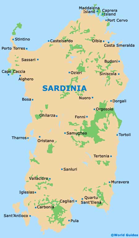
Most of Sardinia's cities and towns lie around the coast, including the capital, Cagliari, set right down in the south. Long stretches of sand, deep bays and rocky headlands separate the towns and cities.
Most urban centres are easily navigable as they are generally compact, although most are centuries-old and have winding streets. For maps, head to the tourist office of the respective city or purchase online before travelling.
From Cagliari
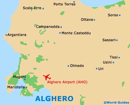
- Alghero - 228 km / 141 miles (three hours and 30 minutes, north)
- Carbonia - 58 km / 36 miles (one hour, west)
- Nuoro - 180 km / 111 miles (two hours and 45 minutes, north-east)
- Olbia - 263 km / 163 miles (four hours, north-east)
From Alghero
- Nuoro - 134 km / 83 miles (two hours, south-east)
- Olbia - 135 km / 83 miles (two hours, north-east)
- Oristano - 136 km / 84 miles (two hours, south)
- Porto Torres - 38 km / 24 miles (one hour, north)
From Olbia
- Costa Smeralda - 10 km / 6 miles (20 minutes, north-east)
- Nuoro - 100 km / 62 miles (one hour and 40 minutes, south)
- Porto Cervo - 31 km / 19 miles (40 minutes, north)
- Sassari - 102 km / 63 miles (one hour and 30 minutes, south-west)
Map of Sardinia
Map of Alghero