Belfast Maps and Orientation
(Belfast, Northern Ireland, UK)
As the
Northern Ireland capital, Belfast is an important and much-visited city, being the second-largest city in Ireland as a whole, and the UK's 14th-largest. Standing at the very mouth of the River Lagan, the city is surrounded by a series of hills (Black Mountain, Cavehill and Divis Mountain) and areas of countryside, with the Belfast Lough, seaport and docks lying directly to the north-east.
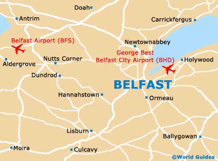
The city resides on the eastern coastline of Northern Ireland and is well supported by various transportation options, being served by no less than two airports (the Belfast International Airport and the George Best Airport). The regional railway networks heads out in all directions, linking destinations such as Bangor (east),
Derry (north-west),
Dublin (south), Larne (north-east) and Portadown (west).
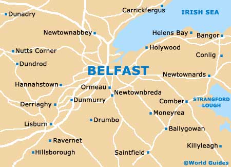
Maps and Orientation of the City
For tourist information and maps, pay a visit to the Belfast Welcome Centre on Donegall Place.
Open hours: June to September, Monday to Saturday - 09:00 to 19:00, Sunday - 11:00 to 16:00; October to May - Monday to Saturday - 09:00 to 17:30, Sunday - 11:00 to 16:00. Alternatively there are tourism desks at both of the airports.
- Andersonstown - 5 km / 3 miles (ten minutes, west)
- Antrim - 30 km / 19 miles (35 minutes, north-west)
- Ballyclare - 22 km / 14 miles (30 minutes, north)
- Ballylesson - 8 km / 5 miles (12 minutes, south)
- Ballynahinch - 23 km / 14 miles (30 minutes, south)
- Ballyrobert - 18 km / 11 miles (25 minutes, north-west)
- Bangor - 21 km / 13 miles (25 minutes, north-east)
- Carrickfergus - 19 km / 12 miles (25 minutes, north-east)
- Crumlin - 23 km / 14 miles (30 minutes, west)
- Holywood - 11 km / 7 miles (15 minutes, north-east)
- Lisburn - 14 km / 9 miles (20 minutes, south-west)
- Monkstown - 12 km / 7 miles (18 minutes, north-east)
- Newtownabbey - 14 km / 9 miles (20 minutes, north)
- Newtownards - 16 km / 10 miles (25 minutes, east)
- Whiteabbey - 11 km / 7 miles (15 minutes, north-east)
Map of the United Kingdom

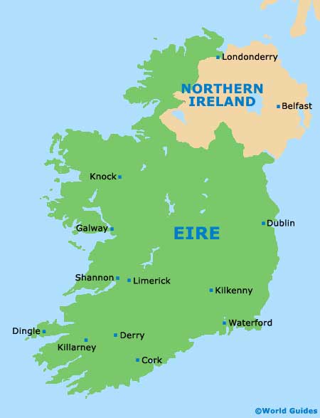
Map of Ireland
Map of Belfast