Santorini Maps and Orientation
(Santorini, Cyclades, Greece)
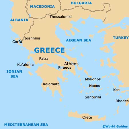
Located directly to the south of mainland Greece and within the Aegean Sea, the volcanic island of Santorini part of the island group known as the Cyclades. Santorini is sandwiched between the neighbouring islands of Anafi and Ios, and boasts some exceptional natural beaches and resorts, which vary greatly and feature everything from fine white sand to dark pebbles.
Home to a population of around 14,000 islanders, Santorini's capital is the town of Fira, on the western coast, and just over 2,000 people live here. Around the island are many further communities, which tend to be scattered around the coastline, where houses are often squeezed tightly together, each one competing for the best sea views.
Maps and Orientation of the Island
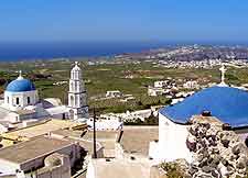
The landscape of Fira is quite breathtaking, and the views of the caldera crater really are something to be savoured. Central to life in the capital of Santorini is the public square named the Plateia Theotokopoulou, which is a good point of reference and interested by the thoroughfare of Martiou, and close to the Erythrou Stavrou, where many shops reside.
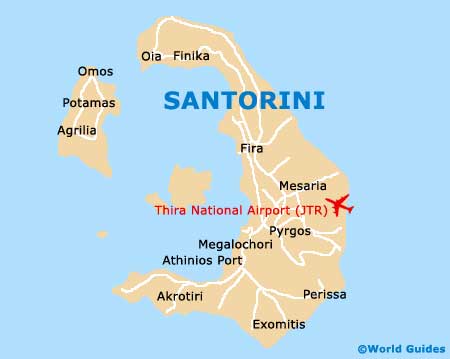
Maps of Fira and the whole of Santorini are recommended for those intending to properly explore the sights. The village of Oia is another place worth a look and lies on the northern side of the island, near to Ammoudi, Armeni Beach, Baxedes and Paradise Beach.
Map of Greece
Map of Santorini