Naxos Maps and Orientation
(Naxos, Cyclades, Greece)
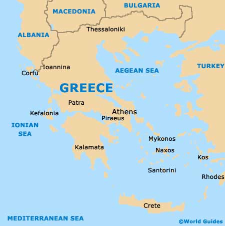
The biggest of all the Cyclades Islands, Naxos lies directly south of mainland Greece and within the Aegean Sea. Naxos is a particularly fertile island and known for both its agricultural and tourism industries, being home to many truly beautiful beaches.
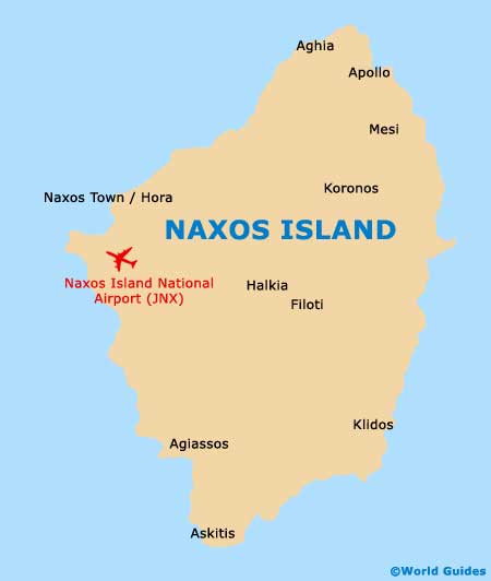
With a population approaching 20,000 people, the island is broadly divided into two main municipalities, Naxos Town (Hora) and also Drymalia, the latter of which comprises approximately 70 percent of the total island space. Hora is the port and capital town, and resides on the western shore of the island.
Maps and Orientation of the Island
Hora is home to a total population of almost 7,000 islanders and features two extremely historical districts, those of Bourgos and Kastro. Located on the northern end of Hora's waterfront, the ferry quay is always a busy part of Naxos, while the island side is where the bus station is located.
Directly to the south of Hora's ferry quay, the Protopapadaki (Paralia) is a good point of reference and brimming with tavernas, cafes and interest shops, while the town's Agios Georgios Beach is also close by and in this area. Maps of Hora and the island of Naxos as a whole are always useful, and available at the privately owned tourist office on the ferry quay itself.
The most significant villages on Naxos include the following:
- Agios Arsenios
- Apiranthos
- Apollonas
- Damalas
- Damarionas
- Filoti
- Glinado
- Halki
- Koronos
- Moutsouna
- Sangri
- Vivlos
Map of Greece
Map of Naxos