Mykonos Maps and Orientation
(Mykonos, Cyclades, Greece)
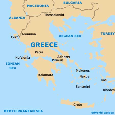
The island of Mykonos lies in the on the far southern side of Greece, where it is one of the popular Cyclades Islands. Mykonos has an overall popular of around 10,000 islanders and is particularly close to a number of the other Cyclades, such as
Naxos, Paros, Siros and also Tinos.
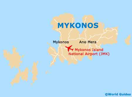
Capital of the island, Mykonos Town is also known as Hora (Chora) and around 6,500 people live here, clearly indicating its size and importance on this busy port town. Hora enjoys a scenic settle on the western coastline of the island, directly to the south of Agios Stefanos, Houlakia, Malaliamos and Tourlos.
Maps and Orientation of the Island
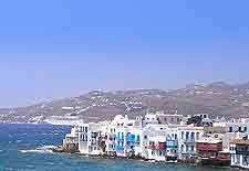
The town of Hora comprises a maze of winding narrow alleys, which are weave there way around between whitewashed buildings. Visitors will find that the Little Venice area of Mykonos Town is especially appealing, featuring a mixture of small churches, boutiques and swathes of pink bougainvillea.
As you walk around Mykonos Town, it is quite likely that you will find yourself walking past the same junction or landmark more than once, since it is very easy to lose yourself here, meaning that maps are very beneficial. Behind the waterfront, streets of Dynameon, Enoplon, Matogianni and Mitropoleos, are well worth familiarising yourself, so that you gain a better understanding of Hora's layout.
Apart from Hora, the following are some further significant communities of the island of Mykonos.
- Agios Stefanos
- Ano Mera
- Ftelia
- Kalafatis
- Marathi
- Ornos
- Platy Gialo
- Psarou
Map of Greece
Map of Mykonos