Prague Maps and Orientation
(Prague, Czech Republic)
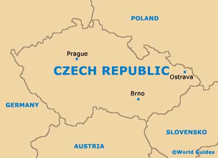
The Czech city of Prague is steeped in history and full of character. Located in central Bohemia, Prague has grown to become the biggest city in the whole of the Czech Republic, where it is also the capital.
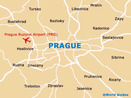
Prague's north and western side is flanked by the curving Vltava River, which is spanned by a series of bridges, such as the Cechuv, Karluv, Manesuv and the Svermuv. The banks of the river are edged by a number of busy roads and these include the Dvorakovo Nabr, the Frantisku and the Nabr Ludvika Svobody.
Maps and Orientation of the City
Many visitors to Prague choose to take a scenic walk through the historic Old Town area (Stare Mesto). A good point to begin a walk is the Old Town Square (Staromestske Námesti), which stands conveniently close to the Staromestske metro station.
When exploring Prague, a map is always a sensible item to bring and will help you to find your way around. Other pleasant walks include the streets around the Josefov district (former Jewish Ghetto), Letná Park, and the southerly New Town (Nové Mesto). Despite its name, the architecture in this part of Prague has a distinct medieval feel and includes structures such as the New Town Hall and various beautiful churches.
- Ceska Lipa - north
- Kelce - south
- Kladno - north-west
- Krepenice - south
- Lhota - west
- Mlada Boleslav - north-east
- Plzen - south-west
- Pribram - south-west
- Ricany - south-east
- Sterboholy - east
- Tursko - north-west
- Ujezd - south
- Vsejany - north-east
- Zavist - south
Map of the Czech Republic
Map of Prague