Salzburg Maps and Orientation
(Salzburg, Austria)
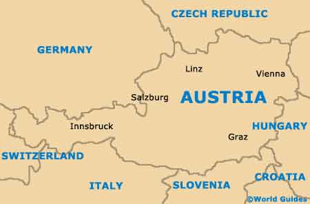
The Austrian city of Salzburg resides alongside the northern side of the Eastern Alps, and extremely close to the western border with
Germany. Famed for its beautiful Alpine scenery and no less than three universities, Salzburg has grown up around the Salzach River and is today home to around 160,000 residents.
For tourists, the pedestrianised Old Town area is where the most interesting attractions can be found and this district is better known in Salzburg as the Altstadt, being recently listed as a World Heritage Site. The bustling shopping street that is the Getreidegasse is also situated within the Altstadt.
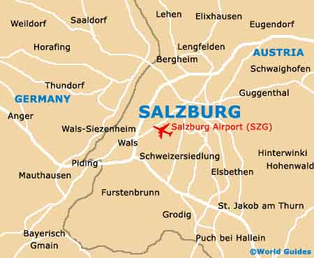
Maps and Orientation of the City
The 'centre of the 'New Town' lies directly north and on the northern bank of the Salzach River. It is in this part of Salzburg that the majority of the cheapest hotels are clustered, being reached from the railway station by taking the Rainerstrasse.
Tourist offices provide free fold-up maps of Salzburg and are located on the Mozartplatz, and also within the main railway station. Maps of Salzburg are always handy, especially if you intend to drive around the city during your stay.
- Bergheim - 6 km / 4 miles (10 minutes, north-west)
- Ebenau - 17 km / 11 miles (20 minutes, east)
- Elixhausen - 13 km / 8 miles (18 minutes, north)
- Elsbethen - 7 km / 4 miles (12 minutes, south)
- Eugendorf - 16 km / 10 miles (20 minutes, north-east)
- Grodig - 10 km / 6 miles (15 minutes, south)
- Hallein - 18 km / 11 miles (20 minutes, south)
- Hallwang - 9 km / 6 miles (15 minutes, north)
- Hammerau - 12 km / 7 miles (15 minutes, west)
- Mühlbach - 17 km / 11 miles (20 minutes, north)
- Schweizersiedlung - 6 km / 4 miles (10 minutes, south)
- Seekirchen am Wallersee - 20 km / 12 miles (25 minutes, north)
- Siezenheim - 7 km / 4 miles (12 minutes, north-west)
- Strasswalchen - 33 km / 21 miles (40 minutes, north-east)
- Trainting - 13 km / 8 miles (18 minutes, north)
- Werfen - 45 km / 28 miles (50 minutes, south)
Map of Austria
Map of Salzburg