Wanaka Maps and Orientation
(Wanaka, Otago, South Island, New Zealand)
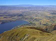
Located on the southerly side of New Zealand's South Island, the resort town of Wanaka is to be found within the heart of the Otago region. The town stands on the southerly shore of Lake Wanaka and near to the Clutha River and famed Mount Aspiring National Park.
Wanaka is rather surrounded by dramatic mountains and is within easy reach of the north-easterly towns of both Twizel and Omarama. On the southerly outskirts of the town, the Southern Alps provide a majestic backdrop, while the beautiful Matukituki River Valley is also within relative proximity.
Maps and Orientation of the Town
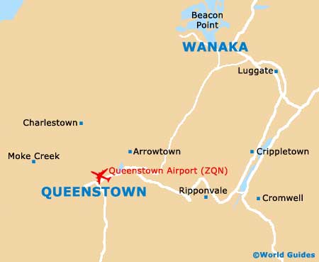
The town is easy to find your way around, although if you are planning to travel further afield, then consider paying a visit to either the Lake Wanaka Visitors Centre or the Department of Conservation (DOC) Visitors Centre, both of which reside on Ardmore Street.
A series of popular resorts stand next to Wanaka, such as the Cardrona Alpine Resort, the Snow Park and Treble Cone, which soon become crowded when the mountain snow arrives in New Zealand's winter months (June to August).
South Island of New Zealand- Alexandra - 87 km / 54 miles (one hour and five minutes, south)
- Arrowtown - 55 km / 34 miles (50 minutes, south-west)
- Cardrona - 24 km / 15 miles (25 minutes, south)
- Christchurch - 428 km / 266 miles (six hours, north-east)
- Cromwell - 55 km / 34 miles (50 minutes, south)
- Dunedin - 277 km / 172 miles (three hours and 45 minutes, south-east)
- Fiordland National Park - 154 km / 96 miles (two hours and 40 minutes, south-west)
- Frankton - 62 km / 39 miles (55 minutes, south-west)
- Invercargil - 243 km / 151 miles (three hours and 15 minutes, south)
- Makarora - 61 km / 38 miles (55 minutes, north)
- Mount Aspiring National Park - 45 km / 28 miles (40 minutes, north-west)
- Portobello - 295 km / 183 miles (four hours, south-east)
- Queenstown - 70 km / 43 miles (one hour and 15 minutes, south-west)
- Timaru - 273 km / 170 miles (three hours and 45 minutes, east)
- Waimate - 229 km / 142 miles (two hours and 55 minutes, east)
North Island of New Zealand- Auckland - 1,500 km / 932 miles (24 hours, north)
- Hamilton - 1,380 km / 857 miles (23 hours, north)
- Wellington - 865 km / 537 miles (16 hours, north)
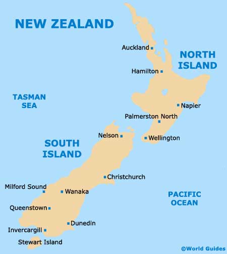
Map of New Zealand
Map of Wanaka