Auckland Maps and Orientation
(Auckland, North Island, New Zealand NZ)
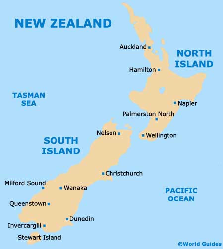
Forming the very heart of the Auckland Metropolitan Area, the city of Auckland resides on the northern side of the North Island, where it serves as a major international gateway for
New Zealand. The city has grown up around an isthmus (narrow strip of land) straddling the Tamaki River and the Mangere Inlet, which at its very narrowest is now more than 2 km / 1.2 miles in width and links the Northland peninsula with the North Island.
Auckland is called home by two important harbours - the Waitemata Harbour (east, opening on to the Hauraki Gulf) and the Manukau Harbour (north, opening on to the Tasman Sea). Several sizeable bridges span the harbours, with the most important include the Auckland Harbour Bridge (Waitemata Harbour) and the Mangere Bridge (Manukau Harbour).
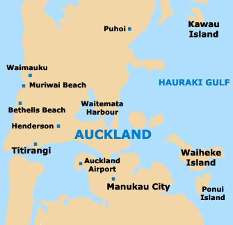
Maps and Orientation of the City
Queen Street lies in the centre of the city and is an important thoroughfare, connecting Karangahape Road with the Britomart Train Station (close to the waterfront), being near to Aotea Square. Other notable streets around central Auckland include K Road, Parnell Road and Ponsonby Road, while in the suburbs, highlights include the suburbs of Devonport, Mission Bay, Mount Eden and Takapuna.
Maps of the city and its suburbs are best options at the official Auckland Map Centre on Queen Street, which is open Monday to Friday - 09:30 to 17:30, Saturday - 10:00 to 16:00, and Sunday - 10:00 to 14:00.
- Albany - 19 km / 12 miles (25 minutes, north)
- East Tamaki - 21 km / 13 miles (25 minutes, south-east)
- Hauraki - 10 km / 6 miles (12 minutes, north)
- Henderson - 17 km / 11 miles (20 minutes, west)
- Karaka - 38 km / 24 miles (45 minutes, south)
- Kumeu - 26 km / 16 miles (35 minutes, north-west)
- Mangere - 18 km / 11 miles (25 minutes, south)
- Milford - 12 km / 7 miles (15 minutes, north)
- Mount Wellington - 13 km / 8 miles (15 minutes, south-east)
- Okura Bush - 29 km / 18 miles (35 minutes, north)
- Oranga - 11 km / 7 miles (12 minutes, south)
- Otahuhu - 16 km / 10 miles (20 minutes, south)
- Papakura - 34 km / 21 miles (40 minutes, south)
- Redvale - 24 km / 15 miles (30 minutes, north)
- Waitakere - 24 km / 15 miles (30 minutes, west)
Map of New Zealand
Map of Auckland