Noosa Maps and Orientation
(Noosa, Queensland - QLD, Australia)
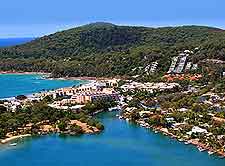
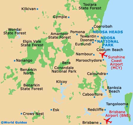
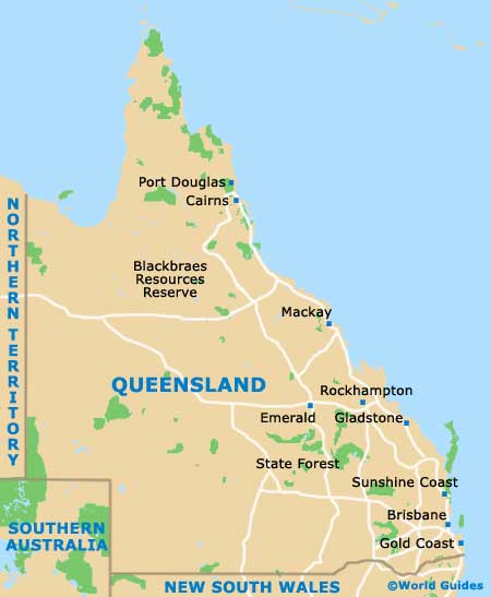
Located on the Sunshine Coast of Queensland, Noosa is a popular tourist destination and resides on the south-easterly side of this Australian state. This region encompasses a number of different communities which lie around the mount of the meandering Noosa River, with much of the action taking place in the beach resort town of Noosa Heads.
Other popular tourist destinations in this part of Queensland include both Noosaville and Tewantin, which serves as the place to catch the Noosa River Ferry. On the far eastern shoreline, Sunshine Beach offers one of the area's very best surf breaks and is easy to reach, while Noosa Junctions tends to form the main region for local businesses.
Maps and Orientation of the City
Much of the focus tends to take place around Hastings Street, which leads to the main beach, as well as the Noosa National Park. Hastings Street is a good place to find tourist information and maps, with the resident Visitors Centre being a good port of call when you first arrive here.
Notable destinations nearby include the following:
- Bauple State Forest - 117 km / 73 miles (one hour and 55 minutes, north)
- Brisbane - 125 km / 78 miles (two hours and 15 minutes, south)
- Caboolture - 84 km / 52 miles (one hour and 35 minutes, south)
- Caloundra - 46 km / 29 miles (55 minutes, south)
- Coolum Beach - 10 km / 6 miles (15 minutes, south)
- Cooroibah - 22 km / 14 miles (30 minutes, north)
- Doonan - 13 km / 8 miles (15 minutes, west)
- Eumundi - 17 km / 11 miles (20 minutes, west)
- Glenwood - 101 km / 63 miles (one hour and 45 minutes, west)
- Gympie - 67 km / 42 miles (one hour and ten minutes, north-west)
- Maroochydore - 29 km / 18 miles (30 minutes, south)
- Maryborough - 163 km / 101 miles (two hours and 40 minutes, north)
- Mount Stanley State Forest - 180 km / 112 miles (three hours, west)
- Nambour - 36 km / 22 miles (40 minutes, south)
- Rainbow Beach - 95 km / 59 miles (one hour and 45 minutes, north)
- Redcliffe - 107 km / 66 miles (one hour and 50 minutes, south)
- Strathpine - 111 km / 69 miles (two hours, south)
- Tewantin - 17 km / 11 miles (20 minutes, north-west)
- Tin Can Bay - 112 km / 70 miles (two hours, north)
- Toolara State Forest - 62 km / 39 miles (one hour and 30 minutes, north-west)
- Toowoomba - 247 km / 153 miles (four hours, south-west)
- Torquay - 193 km / 120 miles (three hours and ten minutes, north)
- Tuan State Forest - 121 km / 75 miles (two hours, north)
- Tweed Heads - 235 km / 146 miles (three hours and 30 minutes, south)
Map of Australia

Map of Queensland
Map of Noosa