Bangkok Maps and Orientation
(Bangkok, Thailand)
Thailand's most affluent and densely popular city, Bangkok is also the biggest city in the whole country. With a population of around seven million inhabitants, Bangkok is a true metropolis and has expanded over the years, swallowing up surrounding locations.
Bangkok stands on the eastern banks of the winding Chao Phraya River (Mae Nam Chao Phraya) and is roughly split into two main regions by the railway line, which runs in a north to south direction. The region located between both the railway and the river is particularly appealing and is known as Old Bangkok, often being referred to as Ko Rattanakosin.
Maps and Orientation of the City
Lying on the southern side of Thailand, Bangkok is a modern metropolis and home to more than 1,000 tall skyscrapers, many of which are quite breathtaking. A map is a necessity for finding your way around the city and a large selection of Bangkok maps are available locally. Those looking to use the city's comprehensive bus network should also be sure to pick up a bus map, while those who prefer to walk will also find several good tours maps around.
Available completely free of charge from the Tourism Authority of Thailand (TAT), the 'City Map of Bangkok' is particularly good and folds down well, comprising the current expressways, bus routes and main city landmarks. This map and others can be found at the various TAT offices within Bangkok and also at the airport.
- Chon Buri - south-east
- Don Muang - north
- Kanchanaburi - north-west
- Mai - east
- Nakhon Pathon - west
- Nonthaburi - north
- Phanom Sarakham - east
- Ratcha Buri - south-west
- Samut Prakan - south
- Samut Songkhram - south-west
- Taling Chan - west
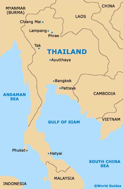
Map of Thailand
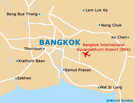
Map of Bangkok