Penang Maps and Orientation
(Penang, Federal Territory, Malaysia)
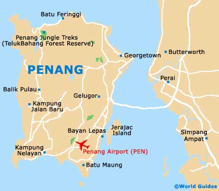
Lying within the Malaysian state of Penang and next to the Malay Peninsula, Penang Island is to be found alongside Seberang Perai. Malaysia's fourth island, Penang is currently called home by almost 700,000 people and roughly divided into two main areas, South-West and North-East.
The island is actually linked to the mainland Malay Peninsula by the very important Penang Bridge (Jambatan Pulau Pinang), a busy dual-carriageway toll bridge (E36), which runs between Gelugor and Seberang Perai. At just over 13 km / 8 miles in length, the bridge is actually amongst the world's longest and transformed transport connections when it opened in 1985, providing a popular alternative to the ferry services to Butterworth.
Maps and Orientation of the Island
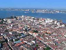
The capital of Penang, Georgetown is located on the north-easterly shore of the island, alongside the narrowest stretch of the adjacent channel. Georgetown is a fairly compact city and most visitors will be able to easily find their way around on foot. Prominent areas of Georgetown include that colonial neighbourhood around Fort Cornwallis, and the financial district surrounding the street of Lebuhrhaya Pantai.
Maps of Penang are always useful if you intend to stray outside of Georgetown, having chosen to rent a car. Close to Georgetown on the northerly coastline, the sandy beaches of Batu Ferringhi are a must. To the far south and within Bayan Lepas, the Penang International Airport ensures that this is another busy part of the island.
- Alma - east
- Alor Star - north
- Borr - east
- Bukit Mertajam - east
- Bukit Minyak - east
- Butterworth - east
- Hat Yai (Thailand)
- Ipoh - north
- Kepala Batas - north-east
- Kota Bharu - north-east
- Kuala Lumpur - south-east
- Permatang Pauh - east
- Pulai Aman (island) - east
- Pulau Gedung (island) - east
- Pulau Jerejak (island) - east
- Seberang Perai Utara - east
- Simpang Ampat - east
- Sungai Petani - north-east
- Taiping - south-east
- Tambun - east
- Tasik Gelugor - east
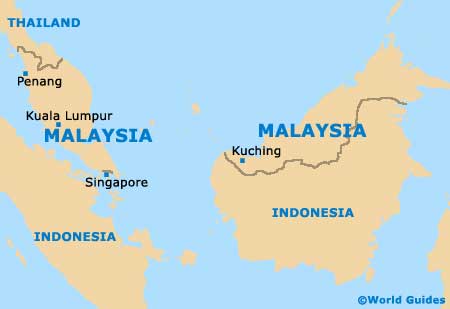
Map of Malaysia
Map of Penang