Jakarta Maps and Orientation
(Jakarta, Java, Indonesia)
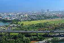
The Indonesian capital of Jakarta lies on the north-westerly coastline of Java Island, where is has a population close to 8.5 million people. Jakarta is an especially wealth city within South-East Asia and is part of the Jabodetabek metropolitan region, where more than 24 million people now live.
Jakarta is very much a sprawling city and stretches more than 25 km / 16 miles from its southern suburbs and docks. Merdeka Square forms the very heart of the city centre, together with other public squares and is where the famous National Monument is to be found. On the south-westerly side of Merdeka Square, the Jalan Thamrin is an important thoroughfare.
Maps and Orientation of the City
To the south, the Jalan Thamrin leads directly into the Jalan Jenderal Sudirman, where a choice of accommodation awaits, along with the rather modern office blocks. Head further south and you will encounter Jakarta's more wealthy suburbs of Kebayoran Baru, Kemang and also Pondok Indah.
If you are after maps of Jakarta, then there are plenty of bookstores around the city, particularly at the Gunung Agung and the Gramedia stores, which are scattered all over the city. Alternatively, the Jakarta Visitor Information Office on the Jalan Wahid Hasyim is home to plenty of maps and leaflets, and is close to the Sarinah department store.
- Anyer - west
- Bali (island) - east
- Bandung - south-east
- Bekasi - south-east
- Bogor - south
- Cilacap - south-east
- Cirebon - east
- Depok - south
- Garut - south-east
- Karawang - east
- Madura - east
- Puncak - south
- Purwakarta - east
- Rangkasbitung - west
- Semarang - east
- Sepong - south
- Serang - west
- Sukabumi - south
- Surabaya - east
- Tasikmalaya - south-east
- Ujung Kulon National Park - south-west
- Yogyakarta - south-east
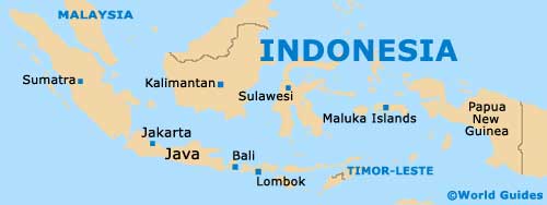
Map of Indonesia
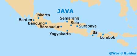
Map of Java
Map of Jakarta

