Semarang Maps and Orientation
(Semarang, Central Java, Indonesia)
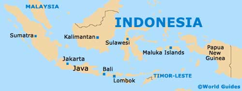
Located on the northern coastline of Central Java, the city of Semarang is known for its busy port and large population of Chinese residents. Some one and a half million residents currently call Semarang their home, and this figure is slowly increasing.
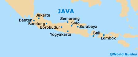
As the fifth biggest city in the whole of Indonesia, Semarang enjoys the status of being Central Java's capital, and is split into a series of 16 different districts (kecamatan), and just under 200 sub-districts (kelurahan). The city is further divided by two rivers, which meander across the eastern and western regions, meaning that Semarang is roughly separated into thirds.
Maps and Orientation of the City
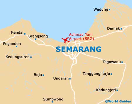
The region known as Old Semarang lies on the northerly coastal plain, between the Banjir canals, while the new town area is based in the south. The southerly section is based on more elevated ground and is known as 'Candi Baru' and 'Candi Lama'.
The Pasar Johar, in Old Semarang, serves as a very important hub for the city and is located to one side of the Jalan Pemuda. During the historical Dutch period of the city, the Jalan Pemuda was the number one boulevard, and still remains a bustling thoroughfare, lined with shops. However, the plaza named Simpang Lima is now the commercial hub of the city, being a good place to find city maps.
- Ambarawa - 28 km / 17 miles (40 minutes, south)
- Bandung - 365 km / 227 miles (six hours and 30 minutes, west)
- Banyubiru - 45 km / 28 miles (55 minutes, south)
- Borobudur - 94 km / 58 miles (one hour and 45 minutes, south)
- Dawe - 54 km / 34 miles (one hour and five minutes, north-east)
- Demak - 26 km / 16 miles (35 minutes, north-east)
- Kudus - 52 km / 32 miles (one hour, north-east)
- Jepara - 74 km / 46 miles (one hour and 35 minutes, north-east)
- Juwangi - 43 km / 27 miles (50 minutes, south-east)
- Kandangan - 47 km / 29 miles (one hour, south-west)
- Mojo - 310 km / 193 miles (six hours, south-east)
- Pacitan - 230 km / 143 miles (four hour and 15 minutes, south-east)
- Pegandon - 38 km / 24 miles (45 minutes, west)
- Sadang - 152 km / 94 miles (two hours and 30 minutes, south-west)
- Solo (Surakarta) - 107 km / 66 miles (two hours and five minutes, south-east)
- Surabaya - 325 km / 202 miles (six hours, east)
- Tambakromo - 70 km / 43 miles (one hour and 20 minutes, east)
- Tegal - 161 km / 100 miles (three hours, west)
- Todanan - 80 km / 50 miles (one hour and 30 minutes, east)
- Wedung - 21 km / 13 miles (30 minutes, north-east)
- Wonosegoro - 55 km / 34 miles (one hour and five minutes, south-east)
- Yogyakarta - 125 km / 78 miles (two hours and ten minutes, south)
Map of Indonesia
Map of Java
Map of Semarang