Agra Maps and Orientation
(Agra, Uttar Pradesh, India)
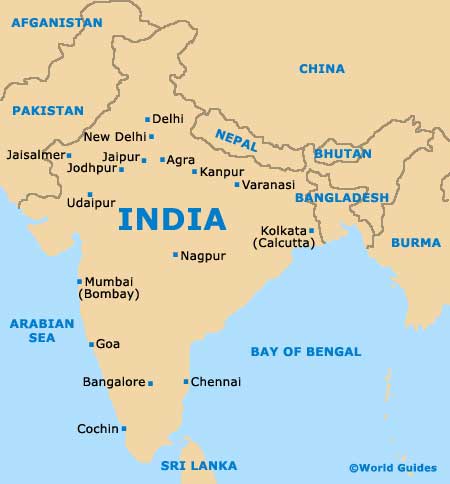
Agra is a large and expansive industrial city, located on the western banks of the Yamuna River and on the Ganges Plain.
Sited within the Indian state of Uttar Pradesh, Agra lies directly south of
Jaipur and just over 200 km / 124 miles south of
Delhi. Agra is therefore extremely well placed for exploring northern India and many visitors choose to visit several cities in this area during their vacation.
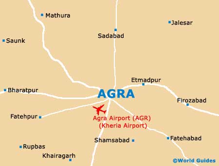
The Mathura district lies directly north of Agra, while the city is edged to the south by Dhaulpur. On the eastern side of Agra you will find Firozabad, a prominent city known for its glassworks. To the east, Agra is bordered by Bharatpur.
Maps and Orientation of the City
Within the city of Agra itself, many locations are often described in relation to the Agra Cantonment Train Station, which lies on the south-western edge of the city centre. To the north-west of this train station is the bustling main marketplace, along with the Kinari Bazaar and also the magnificent fort, around 1.5 km / 1 mile west of the Taj Mahal. The Idgah Bus Station is also located to the north-west and is where the majority of long-distance buses arrive.
A map is necessary should you intend to explore much of central Agra, particularly when driving by car. Many people staying here choose to rent a car from Kheria Airport, which can be found just a short drive to the west of the city.
- Agar - west
- Ashoknagar - north
- Babina - north
- Bhopal - south
- Biaora - west
- Gwalior - north
- Indore - south-west
- Jabalpur - south-east
- Jhansi - north
- Khurai - north-east
- Kota - north-west
- Rajgarh - west
- Sagar - east
Map of India
Map of Agra