Qingdao Maps and Orientation
(Qingdao, Shandong, China)
Qingdao stands at the southernmost edge of the Shandong Peninsula, directly west of South Korea and bordering Yantai on its north-eastern side. Also close to Qingdao is Rizhao, which lies on its south-western side, and Weifang, located directly north-west.
Much of Qingdao boasts a fairly flat terrain, with many areas being surrounded by a rather attractive mountainous landscape. The city's southern coastline is close to a number of small islands and comprises a mixture of sandy beaches, rocky stretches and many wooded areas. Beaches are especially clustered around Jiaozhou Bay, Tuandao Bay, Qingdao Bay, Huiquan Bay, Taiping Bay and also Fushan Bay.
Maps and Orientation of the City
Qingdao's appealing coastal setting has resulting in the city hosting many prominent sailing races, including a number of prominent sporting events at the prestigious Olympic Games in 2008. Many areas of the city have been revamped over the years, with the Olympic Games playing an important part in a number of local projects and renovations.
Well connected to this part of China, Qingdao is close to a large number of expressways and a modern train network, linking locations such as Chengdu, Jinan, Lanzhou and Zhengzhou, amongst other towns and cities. Within the city itself, the roads are organised in fairly structured gridworks around the main districts. On the north-western side of the city, Zhonggang Harbour is a useful point of reference and is located off the Xinjiang Lu.
The following towns and villages lie within close proximity to Qingdao and are shown below with relevant directions.
- Jiaozhou - north-west
- Jinan - north-west
- Laiyang - north
- Longkou - north
- Qingzhou - north-west
- Rizhao - south
- Tai'an - west
- Weifang - north-west
- Weihai - north-east
- Zhucheng - west
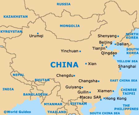
Map of China
Map of Shandong

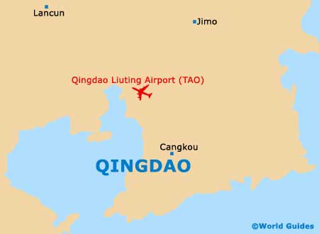
Map of Qingdao