Ghana Maps and Orientation
(Ghana, GH, Western Africa)
Located in West
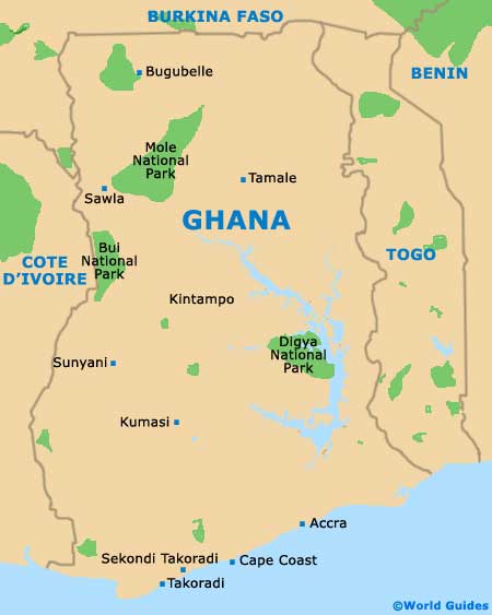
Africa, the country of Ghana lies alongside the Atlantic Ocean (Gulf of Guinea), whilst bordering the countries of Burkina Faso (north), Côte d'Ivoire (west) and Togo (east). Slightly further to the east and next to Togo is the country of Banin, which fronts Niger to the north and Nigeria to the east.
Ghana is actually just a short distance north of the equator and therefore enjoys plentiful sunshine and high temperatures, meaning that the beaches along its southerly shoreline are extremely popular. Comprising spreading flat plains, several low hills and a handful of rivers, Ghana is divided into five main regions - the Low Plains, the Ashanti Uplands, the Akwapim-Togo Ranges, the Volta Basin and the High Plains, as well as the coast.
Maps and Orientation of the Country
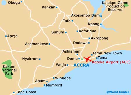
The coastal capital of Ghana,
Accra is also the country's most densely populated city and covers an area of approximately 71 square miles / 184 square kilometres. Other important cities in Ghana include the following:
- Bolgatanga - (Upper East)
- Cape Coast - (Central region)
- Ho - (Volta)
- Koforidua - (Eastern region)
- Kumasi - (Ashanti Kingdom)
- Sunyani - (Brong Ahafo)
- Takoradi - (Western region)
- Tamale - (Northern region)
- Wa - (Upper West)
Continent Map of Africa

Map of Ghana
Map of Accra