Pretoria Maps and Orientation
(Pretoria, Gauteng, South Africa)
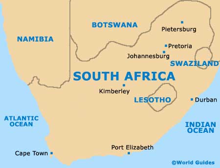
Located on the northerly side of the Gauteng Province, Pretoria is amongst the three capital cities within
South Africa, being the executive national capital city. Part of the Tshwane Metropolitan Municipality, Pretoria is particularly close to
Johannesburg (Jo'burg) and lies directly to the north.
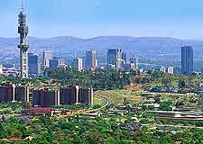
Pretoria enjoys a fairly sheltered setting, being protected by the Magaliesberg hills, which tower just under 1,400 metres / 4,595 feet above the sea level. The city's Central Business District (CBD) serves as a centre for local commerce and government, being filled with large corporate buildings and shops.
Maps and Orientation of the City
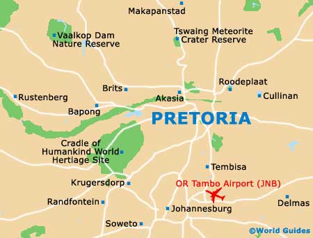
Most people arriving in Pretoria tend to travel by road from Johannesburg, passing the huge campus of the University of South Africa (UNISA) en route, which is located on the south-westerly outskirts of the city.
Central Pretoria is organised as a grid, with Church Street being the backbone and interestingly, at 26 km / 16 miles in length, is currently one of the longest and straightest streets in existence.
- Cape Town - far south-west
- Durban - far south-east
- Evaton - south
- Gaborone - north-west
- Germiston - south
- Johannesburg - south
- Kempton Park - south
- Kruger National Park - north-east
- Modimolle - north
- Mokopane - north
- Polokwane - north-east
- Port Elizabeth - far south
- Rustenburg - west
- Sandton - south
- Secunda - south-east
- Soshanguve - north-west
- Standerton - south-east
- Temba - north
- Vereeniging - south
- Witbank - east
Continent Map of Africa

Map of South Africa
Map of Pretoria