Tunisia Maps and Orientation
(Tunisia, TN, North Africa)
The most northerly of all the countries in
Africa, Tunisia is known for being an Arab Maghreb country (North-West Africa region). It has just two neighbours,
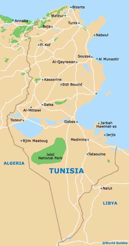
Algeria to the west and
Libya to the south-east.
It is the northern and eastern boundary of Tunisia that has seen this country become such a major tourist destination, being edged by the Mediterranean Sea and lined with beautiful beaches.
The most popular of these beaches have become busy holiday resorts in their own right, such as those around Bizerte, Gabès and Sfax. Also very much of note is the Mediterranean island town of Djerba, along with the lengthy and extremely appealing coastline around Sousse.
Maps and Orientation of the Country
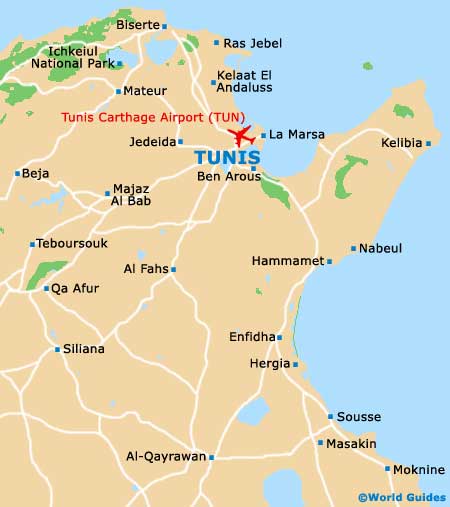
Simplistically, the country is divided into three main regions and these are often clearly indicated on maps. Northern Tunisia is where the capital city, Tunis, is to be found, as well as an assortment of beaches and coastal resorts.
Central Coastal Tunisia is home to both Gabès and Sfax, and offers convenient bus connections to Libya, while Saharan Tunisia occupies roughly two-thirds of the entire country. Here tourists can enjoy desert trekking, some important archaeological sites and various natural attractions, such as those contained within the Jebil National Park.
- Algeria - west
- Egypt - east
- Libya - east / south-east
- Morocco - west
- Niger - south
Continent Map of Africa

Map of Tunisia
Map of Tunis