Hurghada Maps and Orientation
(Hurghada, Egypt)
The bustling holiday resort of Hurghada is divided into three main regions. On the northern side of Hurghada you will find the Ad-Dahar area, where many of the town's most expensive accommodation options lie. This area is full of traditional Egyptian character and worth discovering, with many interesting backstreets and local communities. The main thoroughfare in this part of Hurghada is the Sharia an-Nasr, which is a prominent road connecting many points of interest.
Maps and Orientation of the Town
The Sigala area of Hurghada is located beyond the Gebel al-Afish mountain and is a busy spot which seems to be constantly expanding and in need of more space. Hotels are fairly plentiful in this part of the resort and compete for the best space along the seafront. Ferries can also be found here and connect both Duba and Sharm el Sheikh, standing across the Red Sea and to the north-east of Hurghada.
Directly south of the Sigala area is the main resort strip, which has become an important part of the town and home to a number of notable hotels, shopping malls and top tourist attractions. Outside of Hurghada, the following towns and villages are within driving distance and possibly worth including on your itinerary.
- Abu Shar
- Al Quseir
- Al Uqsur
- Al-Ghardaqah
- Asyut
- Gamasa
- Jabal Abu Gerfan
- Jabal Abu Marwa
- Jabal Sufr al Milahah
- Jemsa
- Port Safaga
- Zeituna
Continent Map of Africa

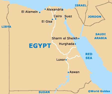
Map of Egypt
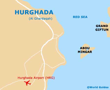
Map of Hurghada