Olympia Maps and Orientation
(Olympia, Washington - WA, USA)
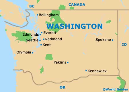
Located within the South Sound area of Washington state, the city of Olympia is to be found directly to the southwest of Seattle. Next to the Budd Inlet of the Puget Sound, Olympia serves as the state capital and also as the county seat for Thurston County.
With a population of approximately 50,000 people, the state capital is not actually the biggest city in Washington state and doesn't even make it in the top 20 in terms of overall size. Seattle is the largest city by far, with its population now exceeding 600,000 residents. Both Spokane and Tacoma are also considerably larger, with populations of more than 200,000.
Olympia features an assortment of parks, green spaces and nature conservation areas. The western side of the downtown district is bounded by Capitol Lake, an artificial lake created in the mid-20th century by damming the Deschutes River estuary. Close by, the city of Tumwater borders the southern side of the city, while Lacey lies to the east.
Maps and Orientation of the City
Downtown Olympia is full of interest for tourists, with its main landmarks often being clearly shown on city maps. On the western side of the city center and close to Capitol Lake is the Washington State Capitol and its neighbor, the Washington Governor's Mansion.
On the eastern side of Capitol Lake is the busy Deschutes Parkway, which heads around much of the perimeter, passing by Percival Cove and the Thurston County Courthouse. Highway US-101 heads through Olympia city center and leads off in a northwesterly direction, while Interstate I-5 heads northeastwards to Lakewood and Tacoma, and to the south, all the way to Portland,
Oregon.
- Auburn - northeast
- Bellevue - northeast
- Budd Inlet - north
- Centralia - south
- Everett - northeast
- Harstine Island - north
- Hope Island State Park - north
- Kent - northeast
- Lacey - east
- Lakewood - northeast
- Portland, Oregon (OR) - south
- Shelton - northwest
- Seattle - northeast
- Tacoma - northeast
- Tumwater - south
Map of USA
Map of Washington
Map of Olympia
