Virginia Beach Maps and Orientation
(Virginia Beach, Virginia - VA, USA)
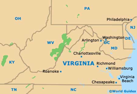
Located in the far southeastern corner of Virginia and within the Hampton Roads area, the city of Virginia Beach resides close to Chesapeake and the North Carolina border. This is the state's largest city, although it is Richmond that serves as the state capital.
Virginia Beach is an independent city, which means that it does not actually belong to a county as such. The main appeal here is the fact that this is a seaside city. The city's Atlantic coastline fronts the entrance of Chesapeake Bay and boasts many miles of sandy beaches.
The city belongs to the Hampton Roads Metropolitan Statistical Area, which also comprises the cities of Chesapeake, Hampton, Newport News, Portsmouth, Poquoson, Norfolk, Suffolk and Williamsburg. Various fast interstates connect the rest of Virginia, such as the I-664 and I-94 (Hampton Roads Beltways), both of which span the harbor and heads towards Hampton and Newport News. The I-264 Interstate (Virginia Beach Expressway) divides the city into north and south regions, heading westwards to Chesapeake, Norfolk and Portsmouth.
Maps and Orientation of the City
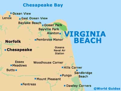
Maps of downtown Virginia Beach clearly show how east-west streets are numbered, while the north-south avenues are named, such as Baltic Avenue, Cypress Avenue and Mediterranean Avenue.
If you are looking for maps, head to the Virginia Beach Convention and Visitors Bureau, which is located on Parks Avenue, next to the Contemporary Art Center of Virginia and just off the I-264.
- Back Bay National Wildlife Refuge - 19 miles / 31 km (30 minutes, south)
- Cape Charles - 43 miles / 69 km (one hour and ten minutes, north)
- Chesapeake - 23 miles / 37 km (35 minutes, west)
- Colonial National Historical Park - 49 miles / 79 km (one hour and 15 minutes, northwest)
- False Cape State Park - 31 miles / 50 km (45 minutes, south)
- First Landing State Park - 8 miles / 13 km (15 minutes, north)
- Fishermans Island National Wildlife Refuge - 33 miles / 53 km (50 minutes, north)
- Great Dismal Swamp National Wildlife Refuge - 50 miles / 80 km (one hour and 15 minutes, southwest)
- Hampton - 31 miles / 50 km (45 minutes, northwest)
- MacKay Island National Wildlife Refuge - 32 miles / 51 km (50 minutes, south)
- Newport News - 40 miles / 64 km (one hour, northwest)
- Norfolk - 18 miles / 29 km (30 minutes, west)
- Poquoson - 43 miles / 69 km (one hour and ten minutes, northwest)
- Portsmouth - 20 miles / 32 km (30 minutes, west)
- Suffolk - 37 miles / 60 km (55 minutes, southwest)
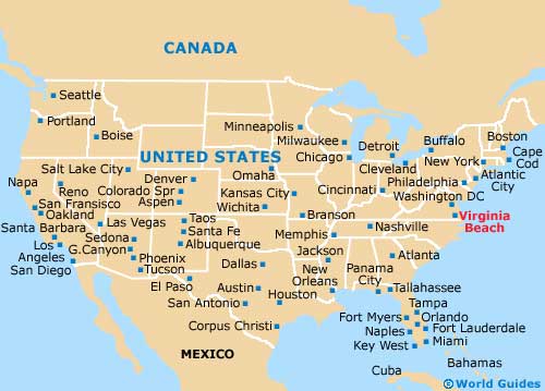
Map of the United States
Map of Virginia
Map of Virginia Beach