Richmond Maps and Orientation
(Richmond, Virginia - VA, USA)
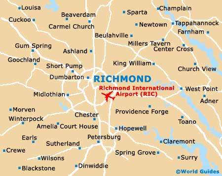
Located on the eastern side of central Virginia and roughly 55 miles / 89 km to the northwest of
Williamsburg, Richmond is actually an 'independent city', which means that it does not belong to a county as such. However, the city does sit within a region known as Piedmont.
The James River has shaped the layout of Richmond and greatly affected its course of history over the years. It was all the way back in the 1730s when the initial layout of Richmond was implemented, with its organized grid of streets and blocks, between today's 17th Street and 25th Street.
The present-day downtown Richmond lies a little to the west of this area, being based around Shockoe Hill. Notable neighborhoods in the city include those around the Virginia Commonwealth University and Monument Avenue, as well as the Museum District, Byrd Park, Maymont, Oregon Hill and the West End. The Northside area of Richmond is where you will find Azalea, Barton Heights, Chamberlayne, Highland Park and also Rosedale.
Maps and Orientation of the City
Tourists planning to explore the city on foot, map in hand, should look out for the Canal Walk, which leads visitors along the waterfront and offers an especially scenic way to view a number of Richmond's historical attractions. The Canal Walk connects the James River with the Haxall and Kanawha canals.
You may also like to check out the waterfront Pumphouse Park (within the William Byrd Park), where remains of 18th-century canal locks, a water-pumping steam engine and an old gatekeeper's house are amongst the principal highlights.
- Bon Air - 10 miles / 16 km (20 minutes, west)
- Chester - 17 miles / 27 km (30 minutes, south)
- Chesterfield - 18 miles / 29 km (30 minutes, southwest)
- Ginter Park - 4 miles / 6 km (ten minutes, north)
- Henrico - 12 miles / 19 km (25 minutes, northwest)
- Highland Springs - 9 miles / 14 km (20 minutes, east)
- Huguenot - 13 miles / 21 km (25 minutes, west)
- Mechanicsville - 7 miles / 11 km (15 minutes, northeast)
- Pocahontas State Park - 23 miles / 37 km (40 minutes, southwest)
- Powhite Park - 8 miles / 13 km (15 minutes, west)
- Presquile National Wildlife Refuge - 21 miles / 34 km (35 minutes, southeast)
- Richmond National Battlefield Park - 16 miles / 26 km (30 minutes, southeast)
- Rivers Bend - 18 miles / 29 km (30 minutes, southeast)
- Roseland - 19 miles / 31 km (35 minutes, west)
- Tuckahoe - 9 miles / 14 km (20 minutes, northwest)
- Wyndham - 18 miles / 29 km (30 minutes, northwest)
Map of the United States

Map of Virginia
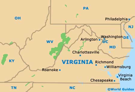
Map of Richmond