Santa Fe Maps and Orientation
(Santa Fe, New Mexico - NM, USA)
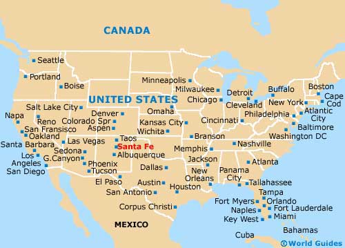
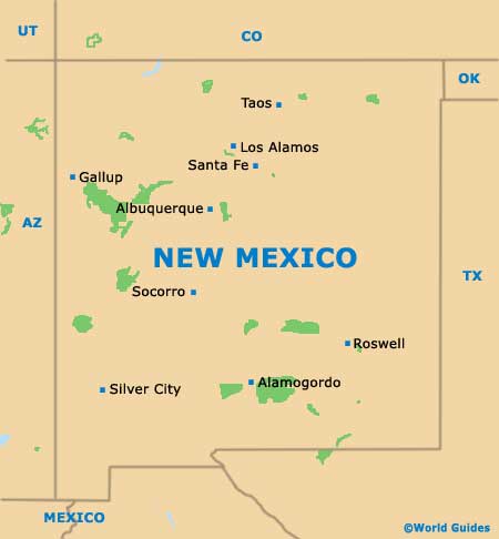
Situated roughly an hour from Los Alamos and sited on the northern side of central New Mexico, the city of Santa Fe serves as the state's capital city, even though it is only the fourth-biggest city in the state, after Albuquerque, Las Cruces and Rio Rancho.
The city is also the county seat for Santa Fe County and features a particularly high elevation of just under 2,200 meters / 7,200 feet above sea level. Interestingly, this altitude makes Santa Fe the highest of any state capital in the USA.
Two prominent highways connect the city with the rest of New Mexico. Highway US-84 / 285 (the Santa Fe Highway) heads northwards to El Rancho, El Valle de Arroyo Seco, San Pedro, Santo Nino and Hemandez. Interstate I-25 (the Canam Highway US-85) skirts the southern side of the city, leading to Albuquerque (southwest) and Las Vegas (east).
Maps and Orientation of the City
To the east, the vast Santa Fe National Forest dominates the natural landscape, spreading for more than 2,400 square miles / 6,215 square kilometers. The park boasts a number of towering peaks, which include those of the Jemez Mountains and also the Sangre de Cristo Mountains.
To the west is the Bandelier National Monument, another giant park with some well-preserved homes and relics from the ancient Ancestral Pueblo People. Just under two hours to the north is the Carson National Forest, where further adobe dwellings can be discovered.
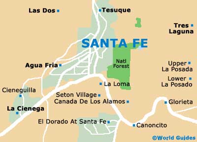
The plaza in downtown Santa Fe is close to a number of the city's historical adobe neighborhoods and museums, which are easily reached on foot. To the south and connected by the Old Santa Fe Trail, the New Mexico Tourism Department is a good place to source maps.
- Agua Fria - 5 miles / 8 km (12 minutes, west)
- Albuquerque - 63 miles / 101 km (one hour and 35 minutes, southwest)
- Bandelier National Monument - 28 miles / 45 km (45 minutes, northwest)
- Cedar Grove - 50 miles / 80 km (one hour and 20 minutes, southwest)
- Chimayo - 28 miles / 45 km (45 minutes, north)
- Edgewood - 62 miles / 100 km (one hour and 35 minutes, southwest)
- La Cienega - 17 miles / 27 km (25 minutes, southwest)
- La Loma - 6 miles / 10 km (15 minutes, south)
- Las Dos - 10 miles / 16 km (20 minutes, northwest)
- Los Alamos - 40 miles / 64 km (one hour and five minutes, northwest)
- Moriarty - 54 miles / 87 km (one hour and 25 minutes, south)
- Pecos - 26 miles / 42 km (40 minutes, southeast)
- Rio Rancho - 56 miles / 90 km (one hour and 25 minutes, southwest)
- Santo Domingo Pueblo - 33 miles / 53 km (50 minutes, southwest
- Taos - 70 miles / 113 km (one hour and 45 minutes, northeast)
- Tesuque - 6 miles / 10 km (15 minutes, north)
- White Rock - 30 miles / 48 km (50 minutes, northwest)
Map of the United States
Map of New Mexico
Map of Santa Fe