Jackson Maps and Orientation
(Jackson, Mississippi - MS, USA)
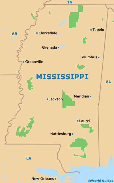
Located just to the south of central Mississippi, Jackson is an important and powerful city, being the state capital for roughly two centuries. Jackson is also Mississippi's largest city, as well as being the county seat of Hinds, along with Raymond town.
The city of Jackson has grown up around the Pearl River, which links the Ross Barnett Reservoir and meanders its way through the city center, along with a number of small creeks. Few people actually realize that the city has been built atop a volcanic crater, named the Jackson Volcano, although this volcano has been extinct for many millions of years.
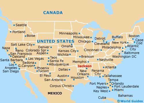
Various interstates surround the city, including the I-20 (east to west) and the I-55 (north to south). Interstate I-55 is an especially busy road, heading all the way to
Memphis (209 miles / 336 km) and
St. Louis (490 miles / 789 km) in the north, and to
New Orleans (189 miles / 304 km) in the south.
Maps and Orientation of the City
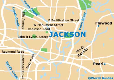
Maps allow you to navigate the city center without any major difficulty. If you need to find your bearings, then look out for important local landmarks, such as the Mississippi Coliseum, the Capital City Convention Center, the Mississippi State Capitol, Battlefield Park and the Jackson State University.
For maps and advice about finding your way around the city, head to the Jackson Convention and Visitors Bureau, which is sited on East Capitol Street and is a couple of blocks north of the Jackson Convention Complex. Also nearby is the Catholic Cathedral of St. Peter, the Marriott Hotel and the Hilton Garden Inn.
- Bentonia - 21 miles / 34 km (40 minutes, northwest)
- Bienville National Forest - 31 miles / 50 km (55 minutes, east)
- Brandon - 14 miles / 23 km (25 minutes, east)
- Brookhaven - 34 miles / 55 km (one hour, south)
- Byram - 11 miles / 17 km (20 minutes, south)
- Canton - 16 miles / 26 km (30 minutes, north)
- Clinton - 10 miles / 16 km (20 minutes, west)
- Crystal Springs - 19 miles / 30 km (35 minutes, south)
- Delta National Forest - 47 miles / 75 km (one hour and ten minutes, northwest)
- Flora - 16 miles / 26 km (30 minutes, northwest)
- Flowood - 4 miles / 7 km (12 minutes, east)
- Hazlehurst - 22 miles / 35 km (40 minutes, south)
- Madison - 15 miles / 24 km (25 minutes, north)
- Panther Swamp National Wildlife Refuge - 36 miles / 58 km (one hour, northwest)
- Pearl - 4 miles / 7 km (12 minutes, southeast)
- Raymond - 17 miles / 28 km (35 minutes, southwest)
- Richland - 6 miles / 10 km (12 minutes, south)
- Ridgeland - 12 miles / 19 km (20 minutes, north)
- Vicksburg - 45 miles / 72 km (one hour and five minutes, west)
Map of the United States
Map of Mississippi
Map of Jackson