Lansing Maps and Orientation
(Lansing, Michigan - MI, USA)
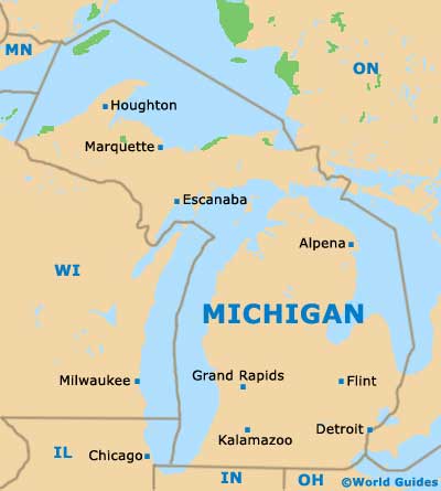
The state of Michigan resides on the north-eastern side of North America, directly to the north of Indiana and Ohio. Lansing functions as the state capital, although it is actually only the fifth-largest city in Michigan.
The state capital of Lansing is rather dwarfed by the giant Michigan metropolis that is
Detroit, which boasts a population now exceeding one million people. Grand Rapids, Warren and Sterling Heights are also all larger in terms of population, although only slightly.
Lansing lies on the southern side of the state, to the west of Detroit, and resides mainly in Ingham County, although a small part of the city does fall within the boundaries of Eaton County. The Grand River meanders its way right through the city center, while its tributary named the Red Cedar River runs through the Michigan State University campus, on the eastern side of the city.
Maps and Orientation of the City
Maps of downtown Lansing show the main interstates and freeways, which help you to get your bearings. Highway US-127 heads north to south, alongside the university campus, with Interstate I-496 running roughly east to west, loosely following the route of the Grand River for a few miles.
A number of the city's principal attractions are dotted around downtown Lansing and radiate outwards from the Michigan State Capitol Building, which is bounded by North Walnut Street, West Ottawa Street, South Capitol Avenue and West Allegan Street. These include the Ferris Park, the River Street Park and the Adado Riverfront Park, as well as the RE Olds Transportation Museum and the Michigan Historical Center.
- Ann Arbor - southeast
- Battle Creek - southwest
- Portland - northwest
- Detroit - southeast
- East Lansing - east
- Flint - northeast
- Grand Rapids - west
- Holt - south
- Jackson - south
- Marshall - southwest
- Mason - southeast
- Mount Pleasant - north
- Sterling Heights - southeast
- Warren - southeast
- Waverly - west
Map of USA
Map of Michigan

Map of Lansing
