Springfield Maps and Orientation
(Springfield, Illinois - IL, USA)
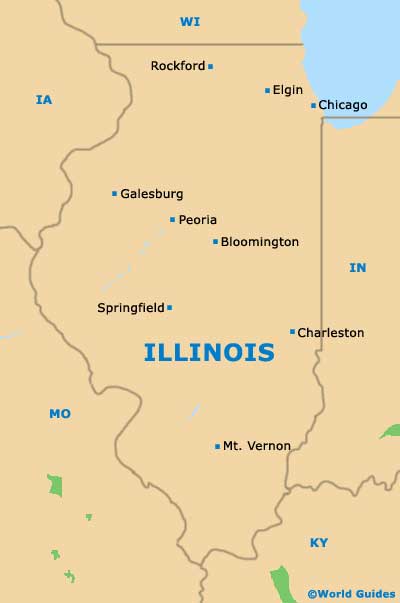
The state of Illinois is sited on the eastern side of central North America, with its capital city being Springfield. However, with a population in the region of 120,000 people, Springfield is far from being the largest city in Illinois. In fact, it is rather dwarfed by the giant of
Chicago and its population of close to three million.
Aurora, Rockford, Joliet, Naperville and Peoria are all also larger, making the state capital of Springfield only actually the seventh-largest city in Illinois.
Founded in the early 1820s and incorporated during the following decade, the city enjoys a fairly flat terrain, being surrounded by areas of lush countryside. The huge man-made reservoir named Lake Springfield lies on the southeastern outskirts of the city, while some noticeable hills are based around the Sangamon River.
Maps and Orientation of the City
Springfield enjoys a relatively central position in Illinois, with its convenient location being the main reason that it naturally became the state capital. The city is well connected to the rest of the state via Interstate I-55 (north to south) and Interstate I-72 (east to west). These interstates are easy to spot on most city maps.
Visitors heading to downtown Springfield will find that the Illinois State Capitol Building is a good place to start your explorations, with many of the principal attractions naturally radiating outwards. The Lincoln Home National Historic Site is around six blocks to the east, while the Cathedral of the Immaculate Conception lies to the southeast, in the Old Aristocracy Hill neighborhood.
- Bethalto - southwest
- Bloomington - northeast
- Chatham - southwest
- Chicago - northeast
- Decatur - east
- Hannibal, Missouri (MO) - west
- Jacksonville - west
- Meredosia National Wildlife Refuge - west
- Morton - north
- Peoria - north
- Petersburg - northwest
- Pittsfield - west
- Springfield - northeast
- Taylorville - southeast
- Vandalia - southeast
Map of USA
Map of Illinois

Map of Springfield
