Panama City Maps and Orientation
(Panama City, Florida - FL, USA)
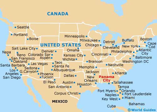
The spring-break haven of Panama City is a relatively small city, being located on the northwestern side of Florida (the Florida Panhandle), roughly mid-way between Tallahassee (east) and Pensacola (west). A part of the Panama City-Lynn Haven Metropolitan Area, the city also belongs to Bay County and is actually the county seat.
Panama City's setting alongside the scenic Emerald Coast has ensured its success as a leading tourist destination. Much of its appeal is centered around the Panama City Beach suburb, a separate municipality located across St. Andrew Bay and to the west, being connected by Highway US-98 (SR-30A).
Also located to the west and close to Panama City Beach is the Lower Grand Lagoon, Lullwater Beach, the Laguna Beach, the La Valencia Beach Resort, Kiska Beach, Carillon Beach and the Camp Helen State Park.
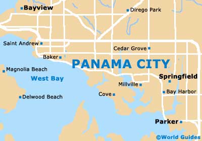
Maps and Orientation of the City
Maps of the region are best obtained from the Panama City Beach Convention and Visitors Bureau. This tourist office is easy to reach, since it is located on the Panama City Beach Parkway / Back Beach Road (Highway US-98), at its intersection with North Arnold Road (Florida-79), and comes with its own car park.
Look out for the white signpost with blue writing at the crossroads, and the distinctive blue / green roofed pavilion. Close by you will find Buddy's Seafood Market and a number of fast-food eateries, such as Waffle House.
- Callaway - 6 miles / 10 km (12 minutes, east)
- Deer Point Lake - 14 miles / 23 km (25 minutes, north)
- Econfina Creek Water Management Area - 21 miles / 34 km (35 minutes, north)
- Fort Walton Beach - 65 miles / 105 km (one hour and 40 minutes, west)
- Laguna Beach - 19 miles / 31 km (30 minutes, west)
- Lynn Haven - 7 miles / 11 km (15 minutes, north)
- Mexico Beach - 24 miles / 39 km (40 minutes, southeast)
- Miramar Beach - 48 miles / 77 km (one hour and 15 minutes, west)
- Pensacola - 103 miles / 166 km (two hours and 40 minutes, northwest)
- Pine Log State Forest - 27 miles / 43 km (45 minutes, northwest)
- Port St. Joe - 36 miles / 58 km (50 minutes, southeast)
- Saint Joseph Bay - 39 miles / 63 km (55 minutes, southeast)
- Seaside - 33 miles / 53 km (50 minutes, west)
- Tallahassee - 100 miles / 161 km (two hours and 30 minutes, northeast)
- Topsail Hill Preserve State Park - 45 miles / 72 km (one hour and ten minutes, west)
- Vicksburg - 13 miles / 21 km (25 minutes, north)
- Wewahitchka - 29 miles / 47 km (45 minutes, east)
Map of the United States
Map of Florida

Map of Panama City