Naples Maps and Orientation
(Naples, Florida - FL, USA)
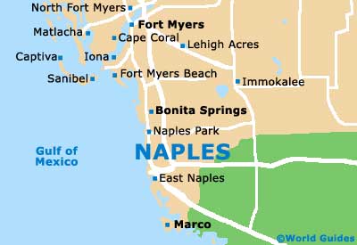
Lying on the southwestern coast of Florida and roughly an hour to the south of
Fort Myers, the city of Naples is to be found within Collier County, where it is the county seat and a part of the Naples-Marco Island Florida Metropolitan Area.
The city resides on the sunny Gulf of Mexico coast and is known for its beaches and coastal destinations. Heading north to south, these include Park Shore, Moorings, Coquina Sands, Aqualane Shores, Port Royal and Keewaydin.
Head further north of Naples and you will find Vanderbilt Beach, the La Playa Beach Resort, the Delnor Wiggins Pass State Park, the Barefoot Beach State Preserve, the Bonita Public Beach, Little Hickory and the Lovers Key State Park, next to Estero Bay. Marco Island is to the south, being connected by the State Highway SR-951 (Collier Boulevard).
Maps and Orientation of the City
Finding an address in downtown Naples should be relatively straightforward. Look on a map and you will soon understand the simple layout and the adopted numbering system of the roads.
Numbered 'streets' head north to south, being intersected by 'avenues' running east to west, with Central Avenue marking the midpoint. 'North' roads are above Central Avenue (e.g. 2nd Avenue North), while 'South' roads are below (e.g. 2nd Avenue South). Centrally located landmarks include Coquina Sands, the Naples Beach Hotel and Golf Club, the Gulfview Middle School, the Von Liebig Art Center and Cambier Park.
- Bonita Springs - 20 miles / 32 km (25 minutes, north)
- Collier Seminole State Park - 17 miles / 27 km (30 minutes, southeast)
- Estero Bay - 20 miles / 32 km (35 minutes, north)
- Fort Lauderdale - 110 miles / 177 km (two hour and 15 minutes, east)
- Fort Myers - 42 miles / 68 km (one hour and five minutes, north)
- Golden Gate - 9 miles / 14 km (20 minutes, east)
- Leawood Lakes - 5 miles / 8 km (12 minutes, east)
- Lely - 6 miles / 10 km (12 minutes, southeast)
- Marco Island - 18 miles / 29 km (35 minutes, south)
- Miami - 125 miles / 201 km (two hours and 45 minutes, southeast)
- Naples Park - 9 miles / 14 km (20 minutes, north)
- Pelican Bay - 7 miles / 11 km (12 minutes, north)
- Picayune Strand State Forest - 25 miles / 40 km (45 minutes, southeast)
- Port Royal - 3 miles / 5 km (ten minutes, south)
- San Carlos Park - 26 miles / 42 km (45 minutes, north)
- Vineyards - 10 miles / 16 km (20 minutes, northeast)
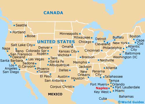
Map of the United States
Map of Florida

Map of Naples