Estes Park Maps and Orientation
(Estes Park, Colorado - CO, USA)

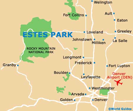
Located on the eastern side of the famed
Rocky Mountain National Park and providing a simply entrance, Estes Park is located in Colorado, within the county of Larimer and an area known as the Front Range. Also close to the Colorado State Forest Park, which lies to the northwest, Estes Park in within easy driving distance of
Denver and
Aurora.
The town of Estes Park enjoys an especially scenic and elevated setting, and has grown up around the Big Thompson River. Although the town's population is only around 6,500 in total, this number swells greatly during the summer season, when the tourism season relating to the adjacent Rocky Mountain National Park peaks.
Maps and Orientation of the Town
A particularly important regional thoroughfare is the Trail Ridge Road, which interestingly has the unusual title of being the highest highway in the whole of the
USA, running from Estes Park and in a westerly directly, through the Rocky Mountain National Park itself and reaching the Grand Lake.
Those driving from Estes Park and into the Rocky Mountain National Park are strongly advised to obtain maps of the area, which will ensure that you may the most of your time and don't overlook any particular places of interest.
- Arvada - 60 miles / 97 km (one hour and 25 minutes, southeast)
- Aurora - 77 miles / 124 km (one hour and 40 minutes, southeast)
- Aspen - 238 miles / 383 km (six hours and 20 minutes, southwest)
- Boulder - 36 miles / 58 km (one hour, southeast)
- Cheyenne - 88 miles / 142 km (one hour and 50 minutes, northeast)
- Colorado Springs - 140 miles / 225 km (three hours, southeast)
- Denver - 71 miles / 114 km (one hour and 40 minutes, southeast)
- Fort Collins - 50 miles / 80 km (one hour and 15 minutes, northeast)
- Granby - 62 miles / 100 km (one hour and 40 minutes, southwest)
- Greeley - 50 miles / 80 km (one hour and 15 minutes, east)
- Lafayette - 46 miles / 74 km (one hour and 10 minutes, southeast)
- Littleton - 79 miles / 127 km (one hour and 45 minutes, southeast)
- Longmont - 33 miles / 53 km (one hour, southeast)
- Loveland - 31 miles / 50 km (55 minutes, east)
- Wellington - 55 miles / 89 km (one hour and 15 minutes, northeast)
Map of the United States

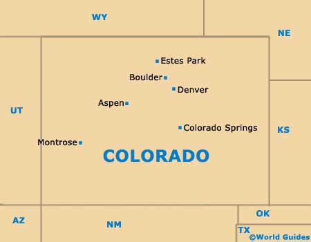
Map of Colorado
Map of Estes Park