San Diego Maps and Orientation
(San Diego, California - CA, USA)
It is easy to understand why San Diego is such a popular Californian city - sunshine, beaches and a downtown district with more than a handful of historic attractions. Located on the southern side of California and next to the border with
Mexico, San Diego resides within the county of the same name, where it is both the county seat and the largest city.
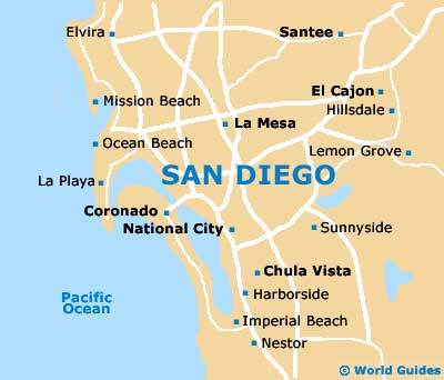
Downtown San Diego is relatively compact and organized. Tourists tend to favor its charming Gaslamp Quarter with its plentiful shopping opportunities and eateries.
Head to the southwest of the downtown district and you will soon reach the affluent Coronado resort, which is connected by a stylish bridge. To the north is Balboa Park and Hillcrest, along with some popular museums and the city's zoo. Both Mission Bay and Old Town San Diego live to the west of the city center.
Maps and Orientation of the City
The adjacent coastline is a huge draw for holiday makers. Its enticing seaside resorts of Mission Beach, Ocean Beach and Pacific Beach all please the crowds of sunseekers arriving from nearby San Diego.
Finding your way around this part of California is made all the easier if you have a map or maps with you. If you are in need of a map, then the International Visitor Information Center is a good place to visit, being located on North Harbor Drive and close to the B Street Cruise Ship Terminal.
- Anaheim - 97 miles / 156 km (two hours and 25 minutes, north)
- Carlsbad - 35 miles / 56 km (55 minutes, north)
- Chula Vista - 10 miles / 16 km (15 minutes, southeast)
- El Cajon - 16 miles / 26 km (25 minutes, northeast)
- Ensenada - 133 miles / 214 km (three hours and 20 minutes, south)
- Escondido - 30 miles / 48 km (50 minutes, north)
- Hemet - 83 miles / 134 km (one hour and 55 minutes, north)
- Los Angeles - 121 miles / 195 km (three hours and 15 minutes, northwest)
- Mission Viejo - 74 miles / 119 km (one hour and 50 minutes, north)
- Oceanside - 38 miles / 61 km (one hour, north)
- Palm Springs - 130 miles / 209 km (three hours and 15 minutes, northeast)
- Rosarito - 51 miles / 82 km (one hour and 20 minutes, south)
- San Clemente - 59 miles / 95 km (one hour and 30 minutes, north)
- Santa Monica - 134 miles / 216 km (three hours and 15 minutes, northwest)
- Temecula - 58 miles / 93 km (one hour and 30 minutes, north)
- Tijuana - 19 miles / 30 km (50 minutes, south)
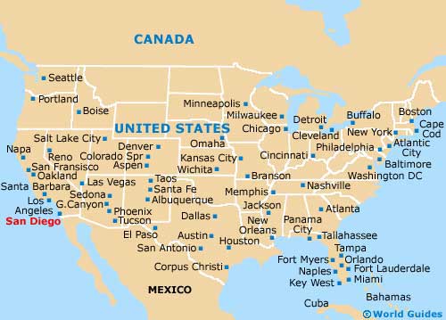
Map of the United States
Map of California

Map of San Diego