Valencia Maps and Orientation
(Valencia, Carabobo, Venezuela)
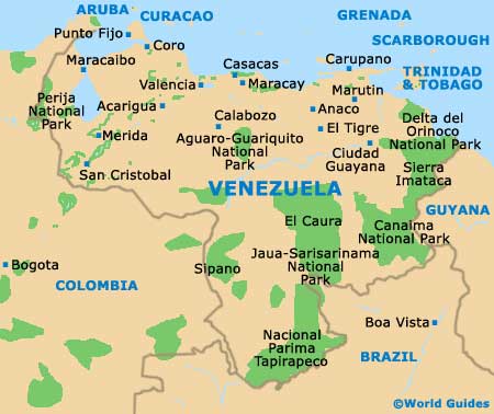
Valencia is located just over 120 km / 75 miles to the south-west of
Caracas, roughly 45 minutes inland from the Caribbean Sea. This city is the capital of Carabobo state, which is one of the principal parts of what Venezuelans refer to as the 'Urban Belt', or the 'Interior.'
Functioning as the main city in a group of five autonomous municipalities that include Libertador, Los Guayo, Naguanagua and San Diego, Valencia is an industrial city with numerous factories on its outskirts. However, the downtown district is very pleasant and feels like a world apart from the big factories.
At the heart of Valencia is the Plaza Bolivar and the
Capitolio building. This historic district has some beautiful colonial buildings that have been restored. The narrow streets are clean and easy to walk, making it one of the few cities in
Venezuela where you can safely explore the place on foot. Most of the city's museums, cultural attractions and historic sites are located in and around the Plaza Bolivar. Spreading outwards from this district is a grid pattern of streets that is easy to navigate. Check out the city's tourism office, just a short stroll to the north of the Plaza Bolivar, to pick up a map and other information.
Maps and Orientation of the City
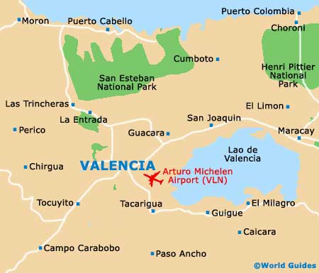
Valencia is literally ringed by massive industrial plants. The north-western side of the urban core is anchored by the pleasant
Casupo Municipal Park, while the southern side of the city is home to the popular Southern Recreational Park and the famous Plaza de Toros Monumental de Valencia, where bullfights are held. The city's grid layout makes it easy to get around and most hotels can provide a basic map that will guide your way. It is unlikely you will need to go outside of the city centre for your sightseeing, dining and shopping, but when you want to visit the parks, you can just grab a taxi or hop on the Metro.
Valencia lies at the intersection of two main highways, so it is easy to drive to neighbouring destinations. Lake Valencia is a massive freshwater lake lying only a matter of minutes to the east, being a popular recreation site. The beautiful San Esteban National Park and the Henri Pittier National Park are also a short drive to the north, on the way to the coast. Some of Venezuela's finest beaches are just 45 minutes to the north, at Puerto Cabello.
- Caracas - 124 km / 77 miles (two hours and 15 minutes, north-east)
- Choroni - 80 km / 50 miles (one hour and 40 minutes, north-east)
- Guacara - 15 km / 9 miles (20 minutes, east)
- Henry Pittier National Park - 75 km / 47 miles (one hour and 30 minutes, north-east)
- Lake Valencia - 15 km / 9 miles (20 minutes, east)
- Las Trincheras - 18 km / 11 miles (25 minutes, north)
- Maracay - 58 km / 36 miles (one hour and five minutes, east)
- Naguanagua - 11 km / 7 miles (15 minutes, north)
- Potrerito - 20 km / 12 miles (30 minutes, north-east)
- Puerto Cabello - 60 km / 37 miles (one hour and five minutes, north)
- Puerto Colombia - 80 km / 50 miles (one hour and 40 minutes, north-east)
- San Esteban National Park - 75 km / 47 miles (one hour and 30 minutes, north)
- Tacarigua - 14 km / 9 miles (20 minutes, south-east)
- Tocuyito - 11 km / 7 miles (15 minutes, south-west)
Map of Venezuela
Map of Valencia