Bayamon Maps and Orientation
(Bayamon, Puerto Rico)
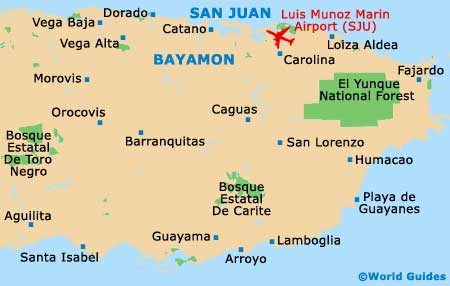
The suburban sprawl of San Juan is such that it has absorbed every neighbouring town and city into its mass. Bayamon is Puerto Rico's second-largest city by population, yet it blends into the metropolitan area thanks to a vast network of highways and roads. Bayamon lies on the south-western edge of San Juan's perimeter. Immediately east is another major city, Guaynabo, which eventually gives way to the international airport and the city of Carolina, and hems in the sprawl on the eastern flank.
Mixed in between these three main urban cores that make up the southern edges of San Juan's metropolis are dozens of smaller towns and suburbs that have attractions of their own. Catano lies between Bayamon and Old San Juan, and is popular for its Bacardi rum factory. Bayamon is known for a couple of museums and a nice cycling path, but most of the area's highlights are along the coast, around Old San Juan.
Maps and Orientation of the City
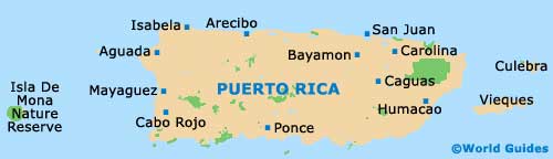
If you want to get a grip on the massive scale of San Juan's metropolitan area and Bayamon's place in it, you will need a good map. These can be found at most newsstands and bookshops, or you can stop by La Castia at Pier 1 in Old San Juan for tourist information. The monthly entertainment magazine, Que Pasa!, is another good source of easy-to-read regional maps. This free magazine is distributed by the tourism office and highlights the main attractions in each suburb.
Old San Juan contains the bulk of tourist attractions, dining and shopping. It is just 2 km / 1.5 miles from the beach and offers plenty of great accommodation, but it is about an hour's taxi ride from Bayamon. Condado, however, is just 15 minutes from Old San Juan and slightly closer to Bayamon. This popular and lively district is more centrally located than Bayamon and therefore may be a better place to base yourself.
- Barranquitas - 40 km / 25 miles (50 minutes, south)
- Caguas - 38 km / 24 miles (45 minutes, south-east)
- Carolina - 30 km / 18 miles (45 minutes, north-east)
- Catano - 15 km / 9 miles (20 minutes, north)
- Comerio - 25 km / 16 miles (30 minutes, south)
- Condado - 13 km / 8 miles (20 minutes, north-east)
- Fajardo - 70 km / 43 miles (one hour and 15 minutes, east)
- Guaynabo - 7 km / 4 miles (15 minutes, east)
- Isla Verde - 19 km / 12 miles (30 minutes, north-east)
- Loiza Aldea - 48 km / 30 miles (50 minutes, east)
- San Juan - 18 km / 11 miles (35 minutes, north-east)
- Vega Baja - 32 km / 20 miles (40 minutes, west)
Map of Puerto Rico
Map of Bayamon