Guatemala City Maps and Orientation
(Guatemala City, Central Highlands, Guatemala)
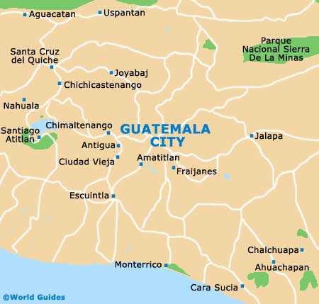
Having Guatemala City maps to hand is a must when visiting the capital. This is a large city - the largest in Central America, and it has many 'zones' (zonas) to seek out. It is not the city to get lost in though, due to pickpockets and spiralling crime, which makes having maps all the more worthwhile.
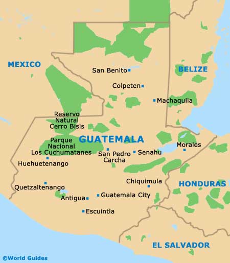
The city itself is nestled in the Ermita Valley (Valle de la Ermita), in the south central part of
Guatemala, and has all highways pointing to it. It is a fair way from the coast and is several hundred kilometres south of the main Maya site of Tikal, in the north of the country. Guatemala City is a good 10 km / 6 miles in either direction of its centrally located Plaza Mayor, although most of the interesting stuff is comfortably within a kilometre or so of the plaza itself.
Maps and Orientation of the City
The Historic Centre (Centro Historico) is the geographical centre of the city and is Km 0 (Kilometro Cero) as far as road maps are concerned. This is where the
Parque Central (Plaza Mayor) and the
National Palace of Culture (Palacio Nacional de la Cultura) reside. Zones then spread out in all directions, with 22 of them splitting the city up into manageable areas.
The most important zones from a tourist point of view are Zone 1 (the Old Town), Zone 10 (where the nicest hotels and shops are clustered) and Zone 13 (the airport). You will need maps for getting around and these are best obtained from the tourist information office on the Avenida 7 or from the Sophos bookstore on the Plaza Fontabella.
- Antigua - 40 km / 25 miles (45 minutes, south-west)
- Chichicastenango - 105 km / 65 miles (one hour and 45 minutes, north-west)
- Ciudad Vieja - 47 km / 29 miles (50 minutes, south-west)
- Lake Atitlan - 80 km / 50 miles (one hour and 30 minutes, west)
- Monterrico - 110 km / 68 miles (two hours, south)
- Pacaya Volcano - 45 km / 28 miles (one hour and 30 minutes, south)
- Quetzaltenango - 200 km / 124 miles (three hours and 30 minutes, north-west)
- Tikal - 380 km / 236 miles (five hours, north)
Map of Guatemala
Map of Guatemala City