Trinidad Maps and Orientation
(Trinidad, Sancti Spiritus, Cuba)
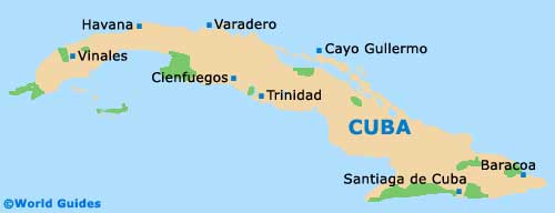
Trinidad de Cuba is located in the coastal centre of the island, around five hours' travel by road from
Havana and some ten hours from
Santiago de Cuba. The town's surrounding valleys were once the hub of sugar production in
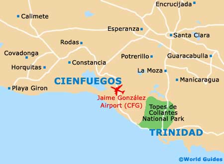
Cuba, and the neighbouring mountains provide a stunning backdrop to the old city and its beaches. Slightly to the north of the town is the Ancon Peninsula.
Modern roads link Sancti Spiritus, the local provincial capital, while a coastal road with superb sea views runs to the relatively nearby city of
Cienfuegos. Trinidad de Cuba is surrounded by unspoiled countryside, parks and nature preserves. If touring by car, maps of the island should be purchased before arrival, as they are scarce in the country and essential for travel off the major roads.
Maps and Orientation of the Town
Trinidad de Cuba is a small town, with its charming old quarter easily explored either by horse-drawn carriage or on foot within a few hours. Much of the town has been preserved and remains almost unchanged since colonial times, although several areas are very run-down and dilapidated.
The village of La Boca is a short journey from downtown and is a picturesque traditional Cuban destination, away from the main tourist stamping grounds. Trinidad centres on its main square, the Plaza Mayor, and the surrounding cobbled streets are home to many of the town's museums and fine colonial buildings. City maps showing the main tourist sites of interest can be obtained at the state-run travel office on Antonio Maceo, near the Plaza Mayor.
- Camaguey - 252 km / 157 miles (four hours and five minutes, south-east)
- Ciego de Avila - 148 km / 92 miles (two hours and 30 minutes, east)
- Cienfuegos - 88 km / 55 miles (one hour and 25 minutes, north-west)
- Havana - 339 km / 211 miles (five hours and ten minutes, north-west)
- Holguin - 453 km / 283 miles (seven hours and 30 minutes, south-east)
- Sancti Spiritus - 69 km / 43 miles (one hour and ten minutes, east)
- Santa Clara - 84 km / 52 miles (one hour and 25 minutes, north / north-east)
- Santiago de Cuba - 649 km / 405 miles (ten hours, south-east)
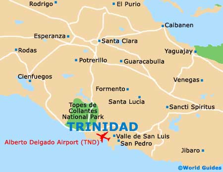
- Topes de Collantes - 20 km / 12 miles (20 minutes, north)
- Torre Iznaga - 18 km / 11 miles (20 minutes, north)
- Varadero - 266 km / 166 miles (four hours and 15 minutes, north-west)
Map of Cuba
Map of Trinidad