Fortaleza Maps and Orientation
(Fortaleza, Ceará, Brazil)
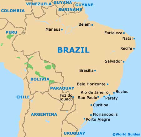
A fairly isolated and surprisingly large city, Fortaleza lies on the far north-eastern side of
Brazil, within the state of Ceará, where it enjoys a scenic coastal setting, alongside the Atlantic Ocean. Fortaleza is now home to some 2.5 million residents and growing, and serves as the state capital, being close to cities such as Eusébio, Maracanaú and Pacatuba.
Stretching some 20 km / 12 miles along the coastline and approximately 10 km / 6 miles inland, Fortaleza is home to many bustling streets. The Centro area forms the most historic part of the city and is slightly elevated, standing at around 200 metres / 656 feet above sea level.
Maps and Orientation of the City
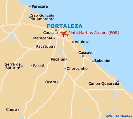
Tourists will soon realise that the main places of interest lie on the eastern side of the Centro area, where the Praia de Iracema area awaits, together with a series of eateries and hotels. However, despite its popularity and name, there is no real beach here.
The appealing beach suburb of Meireles is where many of the most popular hotels reside and this part of Fortaleza is situated just over 2 km / 1.5 miles to the east of Centro. Close by is the port of Mucuripe, while further east is the stunning beach of Praia do Futuro.
Visitors looking for maps of Fortaleza will find that bookstores are fairly scarce, since this is primarily a beach resort. The Shopping Iguatemi centre is a good place to look for maps, as are the tourist outlets on the Avenida Beira Mar, the Praca da Ferreira and the Rua Senador Pompeu.
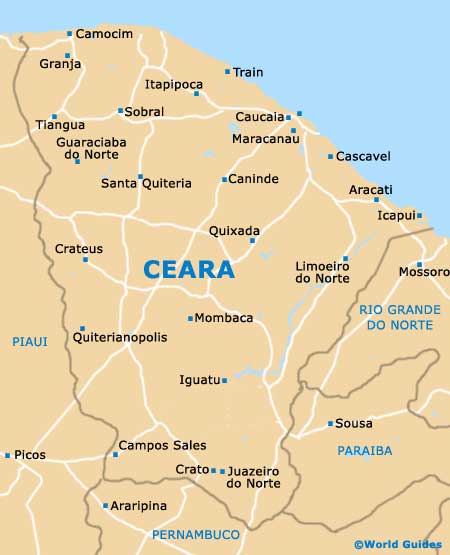
- Aquiraz - 35 km / 22 miles (45 minutes, south-east)
- Aracati - 168 km / 104 miles (three hours, south-east)
- Baturité - 96 km / 60 miles (two hours, south)
- Canindé - 116 km / 72 miles (two hours and ten minutes, south-west)
- Cascavel - 70 km / 43 miles (one hour and 20 minutes, south-east)
- Eusébio - 29 km / 18 miles (40 minutes, south)
- Itaitinga - 35 km / 22 miles (45 minutes, south)
- Itapipoca - 135 km / 84 miles (two hours and 30 minutes, north-west)
- Maracanau - 33 km / 21 miles (45 minutes, south)
- Morada Nova - 169 km / 105 miles (three hours, south)
- Mossoro - 261 km / 162 miles (four hours, south-east)
- Natal - 538 km / 334 miles (eight hours, south-east)
- Pacajus - 56 km / 35 miles (one hour and 15 minutes, south)
- Pacatuba - 34 km / 21 miles (45 minutes, south)
- Sobral - 227 km / 141 miles (three hours and 30 minutes, west)
- Tiangua - 310 km / 193 miles (four hours and 45 minutes, west)
- Trairi - 134 km / 83 miles (two hours and 30 minutes, north-west)
Map of Brazil
Map of Ceará
Map of Fortaleza