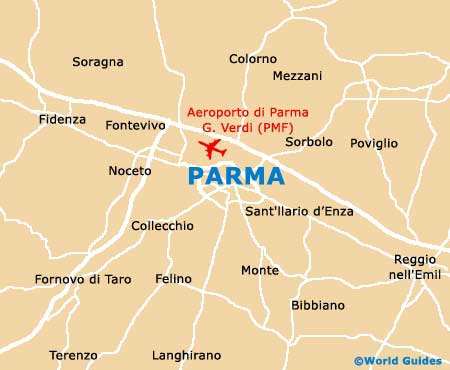
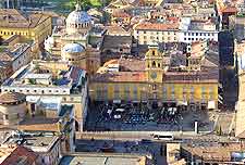
Parma Neighbourhoods, Locations and Districts
(Parma, Emilia-Romagna, Italy)
Located within the province of Parma, the city of Parma is small enough for visitors to orient themselves within a short space of time. Indeed, the city centre can be easily split into just two main districts and a number of smaller neighbourhoods. These are divided by the River Parma, which runs from the north to the south of the city.
An inner ring road marks the outer limits of Parma's historic quarter, while an outer ring road, known as the Tangenziale, encircles the whole city, suburbs and all. The following locations will be of particular interest to tourists.
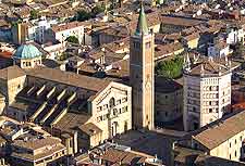
Historic District
On the east side of the River Parma, the historic district covers the area around Piazza Garibaldi, including Via Mazzini, Via Republica, Via Garibaldi and Via Farini.
As well as bars and shops, this neighbourhood also includes the majority of the city's main attractions, including its historical palaces and museums.
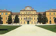
Oltretorrente District
This neighbourhood lies west of the River Parma. Whilst Oltretorrente has still managed to retain a traditional atmosphere, many of its streets and squares have undergone some modernization. Oltretorrente's most popular attraction is the Parco Ducale and its grand palace.
Fiere di Parma District
Located to the north of the city centre, just on the outskirts, is the often extremely busy trade fair district. Based around the vast Fiere di Parma exhibition centre, this neighbourhood really comes to life during Parma's main trade fair season in the spring and autumn. Good transport links and plenty of hotel accommodation are on offer here.